Sunday, 23 December 2018

Wangaratta rail trail part 2

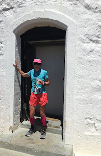
It was hot hot hot for my run from Wangaratta to Milawa to Beechworth and back to Wangaratta this week. I wanted to do the other section of the Murray to Mountains Rail Trail (I did the main trail earlier this year, and I thought at the time that it would also be nice to run to Beechworth). The timing of the Melbourne to Wang train makes it feasible to stay the first night in Milawa with a reasonable run that afternoon.

When I got off the train at 3.15 in Wangaratta the heat hit me in the face. I thought, I can’t run in that! It was 33 degrees. I only took 600 mls of water for what I thought was a run of 16 kilometres. Turned out the trail distances are inconsistently described/marked to say the least. They seem to pick some arbitrary point to start measuring (it’s a secret) and don’t always use the same point. And the maps don’t agree with the trail signs. For the record I ran 20.2, 35.5 and 44.5 kilometres. I feel I must note how stupid I felt carrying a rain jacket and fleece all three days.

I was struggling with the heat from the beginning, allowing myself frequent stops but having to ration how much I drank. I ate all my lollies (not many) at my first stop. It was all very peaceful, lots of cows in the paddocks and not much other signs of life. It was certainly flat. When I got to Oxley I was absolutely delighted to find a little park with a water tap. Despite drinking enough I was still having to take walking breaks for the last 4 kilometres into Milawa. I had a nice evening in the pub. But I don’t think I rehydrated anything like sufficiently.

As soon as I started running the next day, at 7.30am, I was hot. I had hoped for a little time in cooler temps, but the sun was out and there was no wind. I took 1.6 litres of water. The first half of my run was on roads and I had prepared a little map, but it turned out the route was easy to follow. This part was pleasant with quiet scenery and again lots of cows. In my mind the run was divided into pre and past Everton, where I would join the rail trail; for some strange reason I thought the rail trail portion would be easier even though I knew it is all uphill.

In Everton I went into the general store and bought a bottle of Passiona, drinking it almost straight down. I was so hot. Then I had a few kilometres to reach the rail trail. I had a long sit at the trailhead. My day was over as far as my legs were concerned.

I ran and walked the rail trail as best I could, with frequent stops, preferably in the shade. There was no shortage of flies and they bothered me a lot more when I walked. Some of the trail was tree lined and some was totally exposed. Most of it was uphill but the grade didn’t bother me. I only saw two small groups of cyclists. I forced myself to keep going, with reducing stretches of running. When I reached Beechworth I went into the bakery and someone engaged me in conversation, telling me his son was a keen ultra runner, but when I opened my mouth to reply I had trouble getting any words out. The rest of the day I made more effort to rehydrate.

The third day felt to me like it started out cooler. I quite enjoyed the rail trail although it wasn’t all downhill. Strange, that. But once I got past Everton station I again felt cooked. I told myself I only had to get to Bowser, because I thought I could buy a snack and drink at the motel there if I was desperate but even that was 19 kilometres away. I had a lot of stops and ate my emergency muesli bar. There was a lot of debris on the trail - branches and dirt - and not a single bike. I even had a slight tailwind but it hardly seemed to help.

Once I got to Bowser (where the motel did not appear to be functioning) I realised I still had some way to go: 8 kilometres, most of which was on a levee and of course hot. I emerged at Apex Park, the official end of the trail, but I didn’t feel like I had finished; I could either continue into town or go to the station to complete my loop. I walked back and forth across the river trying to decide what to do as I was unsure of the distance for each option (at least this faffing around got my total up to 100 kilometres!) and finally opted for the station, running by the river and then on deserted streets. I was too exhausted to feel much relief at finishing.

Sunday, 16 December 2018

Mt Juliet hike


Last week I got some great hikes done in Tasmania, especially the Walls of Jerusalem, so I wanted to be sure to keep this up when I came home. I picked the hike up Mt Juliet near Healesville for my first hike. Now, I won’t be recommending this hike to anyone because it’s more the sort of hike you do in order to have done it, rather than for the pleasure of the experience, but I’d read about how steep it is and I wanted to see for myself.

Verdict: yes, some parts are really steep, but a lot of parts aren’t so bad. The main thing about this hike is that you get to see a lot of forest, a lot of tree trunks (fallen and upright) and not much else. No views, no clearings, no space for wildlife sightings. Although I saw three disappearing wallabies and a fair few crimson rosellas. There is one section near the top where the mountain ash are spectacular but other than that it’s just forest, some with ferns and some without.  A certain mistiness added atmosphere. 

There’s a disproportionately large summit cairn and a sign at the summit so you don’t continue on (under the false impression that summits always offer views).

It had been raining heavily the past few days so I expected the track to be muddy, but it was merely damp; there wasn’t any mud as such. There were many fallen trees, some quite challenging to clamber over, and some that had obviously been in situ for a very long time. The track is quite overgrown so I was constantly pushing wet branches out of my face. For this purpose my hiking poles proved invaluable.


I was alone on the ascent, over 900 metres in about 5 kilometres, and on the way down I only passed two hikers. From my point of view this was good because I was sure I was going to be slipping over and falling on my descent and I didn’t want spectators. But I didn’t fall once, although I skidded a few times. The  descent was not as difficult as I expected, and after I completed the steep sections it was really easy going. I arrived at the end of the hike feeling completely relaxed and fresh.

Sunday, 9 December 2018

Bruny Island Ultra 64 km, 1 December


I had a busy November and I kept going until 1 December just to be sure. In November I did Carcoar Marathon, Marysville 50 km, weekend off, Lilydale Marathon and then I ran the Bruny Island Ultra 64 km on 1 December to end my year of races.

Bruny Island was a bit different from other ultras in having only two (very modest) aid stations on the course so we had to bring our own support. I took Dom. He drove while I ran, and we met up at intervals so that he could hand me lollies and drinks. Most of the field is made up of teams whose members run segments of the course which can range from two kilometres to doing 32 km each as a couple, or any variation in between. So it’s a fully supported relay race with a contingent of solo runners.

I was nervous about how it would be to run with so many cars (one per solo runner and often several per team) sharing the road, whether I would spot Dom among the support vehicles and whether he would spot me. In the end none of these became issues, the cars didn’t throw up too much dust on the dirt roads and I didn’t feel as though I were running in heavy traffic. Although there was a bad bit of snarl up as I approached the lighthouse right at the end of the race where I had to weave through the cars. And as we drove away from the finish after the race this problem had become much worse with the cars unable to move forward or back and the runners having almost nowhere to run (or walk).

A great deal of the route was on gravel roads and almost none of it was flat. The hills were gradual and longer in the first, northern, half of the course and shorter but steeper on South Bruny. I was keen to see how long I could run without walking and I didn’t walk until after 52 km. Not sure if this was wise, but even then I only walked a little. 

You have to nominate your own start time for the race, based on finishing between 11am and 2.30pm. It’s hard to pick a start time without knowing the course but I thought eight and a half hours should be adequate and I ended up starting at 5.45am. When I checked in at the start I was surprised that 3/4 of the solo field had already started. I got passed by several runners early on, which made sense as they should be faster, but this also suggested I had started too late for my pace. I hardly saw any of the solo runners until much later on when I picked off a few. 

I strolled down to the start at the pier in Dennes Point at the top of North Bruny Island and got going. Daylight was well under way. There was an immediate long uphill and at the top a great view of little islands and bays to the east. It promised to be a lovely day although still quite cool. Ups and downs followed and I got into a rhythm as I progressed alongside farmland. I saw Dom at the 12 km point and from then on every six kilometres. Crew were permitted to stop every two kilometres and I found if handy to look forward to these points even when I ran through them, as the supporters were friendly and these short chunks of distance gave me something to focus on. I tended to see the same team support crews at each stopping area so we established quite a rapport. It was just peaceful pastoral scenery with a lot of sheep.

Close to the Neck, which links North and South Bruny, we were again by the water and had a bit of flat. My stomach was playing up, unusually for me, and then my left foot started to hurt. I tried to push through. The foot pain went away but the stomach issue remained. I think it may have been the horrible tap water at the place we stayed. The Neck was an impressive sight, lots of water on both sides of a narrow causeway.

South Bruny had more civilisation than the north and I was keen to see what the small town of Alonnah would be like. Actually it wasn’t much but there was a small aid station with cups of Gatorade and a huge bowl of lollies at the 40 km mark near the island's only pub. There was also a suggestion of more hills. The road was sealed for a short while then went into forest and was gravel the rest of the way. There were stretches of farmland and another small settlement, Lunawanna, where there was an impromptu aid station with water and Gatorade by the community hall. I grabbed a bottle of water since until then I had been drinking exclusively sports drink (because I thought that we had only brought the awful tap water in our water bottles). 

In the final kilometres I had to dig deep but I was also pleased to be passing people. It may not have meant much because they would have started before me and intended to run slower but it felt good. I walked a few of the steeper hills and Dom was meeting me every four kilometres. Kms 58 to 60 seemed the shortest of the day as there was a long steepish downhill, but the ground was sometimes a bit slippery due to the crushed gravel surface which was very dry. The day was warming up.

Around 62 km I had my first view of the lighthouse, my destination. It was perched on a hillside, of course, lighthouses are not generally on the beach, but it looked far more than two kilometres away. So I greeted Dom at the 62 km aid point with a big expletive. Actually it was about the right distance, although I had to fight through cars to get there. By the time I reached the final push Dom had parked and was walking towards the finish; I saw him just before the final hill up to the lighthouse so we did this bit together. This was tricky as the narrow path was also the only way to leave the lighthouse for runners and crew. Full teams of runners in some cases.


It was great to finish. Lovely views in all directions of bays and beaches. Beautiful lighthouse. I forgot to turn off my watch because I’m not used to wearing one, but I found out later that I ran 7 hours 18 minutes. 


After a short while we went to Cloudy Bay to relax on the beach and then back to the pub in Alonnah for chips and beer.

Wednesday, 14 November 2018

Marysville 50 km, 11/11/18


I had a great run at the Marysville 50 km race. I always enjoy this one, despite the ferocious hills, but I was not expecting to do a PB on the course this weekend. Especially after having done the very hilly Carcoar Cup Marathon the previous weekend, where I felt good and thought I was running strongly right up to the end, only to find that I ran this one slower than last time in 2014. There were lots of similarities between the two races: lovely scenery, smallish field, enthusiastic aid stations and not much flat ground. The hills in Marysville are far steeper, and the trails are rougher.

My day in Marysville didn’t start out the best when I got to the first aid station and realised I was supposed to bring a cup with me. I have several collapsible cups but they were all at home. For the first two aid stations I was able to use a real cup that the aid stations had available for idiots who arrived without a cup. Between aid stations I scoured the roadsides for discarded bottles but saw none, just a few crushed cans. That’s a good thing really. Then at the third aid station I thought to look in the rubbish bag and I found a bottle which lasted me the whole day.

As in Carcoar I started out near the back of the field. I don’t like being there, so I saw it my duty to ensure that I wouldn’t be finishing back there. In Carcoar I managed to move up near the middle of the field, and in Marysville I was more confident because I know the course and how you can burn out before the final really steep hill.

The weather was perfect in Marysville, sunny and clear but not too hot. This was the tenth anniversary race. The first year it was stinking hot. One of the early years it rained and there was a lot of mud. The other years, with a new course which came as a shock to those of us who had done the old course because we hadn’t anticipated the new steep hills, it has been hot. So warm rather than hot was a pleasant treat.

I’ve gone back to running with music in races after a long break. I think I like it. I ambled along enjoying the scenery as we climbed out of Marysville and got onto Lady Talbot Drive, a long dirt road by the river. The road ends with a big climb and then us ultra runners do an extra bit that the marathoners don’t have to do. It was undulating and I pretty much ran it all, but there were many downed trees to clamber over. I thought the gradual hills would be a time to move up a few places and I managed that, only to be passed on the following long downhill. I also had lots of marathoners for company when I reached the downhill and I was a bit surprised because I didn’t remember this happening in past years.

After another session on Lady Talbot Drive, a stretch which has seemed endless to me in the past, came the second major hill. This one I always remember well. It’s a bit grassy and very wide and as I power hiked up I managed to pass some people. I knew there was a long downhill coming but I had forgotten an intervening undulating stretch. I think it really helps with this race to know the course. I was basically running as fast as I could on the level to undulating bits because I knew I would be walking substantial portions later on.

We followed the river back to race HQ and then set out for the trek to the Steavenson Falls and the big hill. The climb starts with a steep sealed road and ahead of me I could see masses of people; it looked very strange, like they were on an outing together but in fact they were a mixture of tired marathoners, tired ultra runners and random walkers. 

I was anxious to get to the hill proper and see if I had the strength left to do my thing on it, ie hike up with purpose. There’s a long preamble to the hill, though, and even some downhill that I had forgotten. Eventually the main climb started. I grabbed a stick to use while hiking, then it broke to I got another one and used it until it too broke. Doc Lachlan, who designed this course and has been very instrumental in getting the race weekend started and keeping it going, came up behind me and I said to him "I love this hill, I look forward to it every year." I don't know what he said in reply. Hopefully he realised I said that for my own benefit, to keep things positive.

Some parts of the climb were really steep; vertical is the word that comes to mind. But I made it to Keppels Lookout, and I still maintain that it has never seemed as hard as the first year it was part of the race route. The undulations that follow are never pleasant because there’s more climbing and the ground is uneven. But I knew I just had to hang in there. In fact straight after the lookout I got a renewed burst of strength. I still did not realise I could do a course PB.
Getting to the Falls is almost an irritation in this race because of the two seemingly unnecessary detours we have to make to the lower and upper falls. I barely glanced at them, anxious to finish my run. But I have to say that I enjoyed the final kilometres, really noticing how they were downhill, and when I got back to the river bank I just went with the flow, not anticipating/hoping feverishly that the turnoff to the finish would be around every bend. I have found this last part very difficult in the past when the end never comes soon enough.

As it happened I got to the oval where we finish with Lachlan right on my heels and I could tell I wasn’t going to get a mention from the race compere if I finished at the same time as him. So I sped up, and I got quite a surprise when I saw the time on the clock: 6 hours and 3 minutes which was 13 minutes faster than last time. 
The next day I went for a hike at Lake Mountain. My legs were soooo tired that I had to cut the walk short. I never do that!

Sunday, 7 October 2018

100 kilometres de Millau, Sept 29, France


I have happy memories now from a day which I initially thought I was going to look back on as unremittingly horrible. I started out feeling awful, really lethargic, and ended up feeling pretty good, actually quite surprised at how well I could run after having been running for so many hours. It was a very warm day but even that didn’t spoil things for me, although my day really picked up when the sun went down.

There were some rather unusual aspects to this race, the most obvious one being that runners were allowed to be accompanied by a supporter on a bicycle for the final 93 kilometres of the route. I was very alarmed when I first heard this because I thought that so many bikes on the course would be a nuisance, but even though it seemed that most runners had a bike rider with them the bikes were rarely an issue. Having the bikes around meant that, as the field spread out, even when I couldn't see other runners I could generally see a bike so I didn’t feel so alone, and all those bikes gave me something else to look at when the scenery palled. I felt for the bike riders since 100 km is a lot to cover by bike at a slow pace, or at a fast pace for that matter. Some of the bikes seemed to settle into groups and be enjoying themselves as if they were just out there for a day ride while others stayed right by their runners. Many of them had boxes strapped to their pannier racks for their runner's bottles and carried a lot of gear. I carried my stuff myself, but only water, phone and sunblock. 

The other unusual feature was that at 9.30 before the race start we had to get into the race corral and then walk in procession for about a kilometre through the town of Millau, all of us packed tightly together. This was slow work and not nice at all, but apparently compulsory. There were well over 1300 runners in the marathon or 100 km, the majority in the longer race. Then at 10am the real race started, and a wiser person would have snuck into the race at that point.

I started the day with a cup of instant coffee and two croissants from the bakery across the road from my hotel. The race started so late that I had time to go out and buy breakfast.

The entire route was on sealed roads, both major and minor, and was virtually all closed to traffic. We started with running the first of two loops, a marathon. Only a quarter of the field were doing just the marathon and they were mixed in with the rest of us. I hadn’t paid much attention to the route profile except to read that the first 20 kilometres were flat and that there were hills in the second loop. I should have done my homework better. 

In the early kilometres we went out of Millau into the Parc Regional des Causses and near the Tarn river and gently undulated below high limestone cliffs. We passed a strange looking ruined castle that looked like it could fall off the mountainside at any moment and there were pretty Provençal type villages all over the place, some on the sides of the mountains. It was generally pretty scenery without being sensational, but I’ve become spoilt by the good stuff I’ve seen this summer. There were a few supporters in the villages, not like in the Tours marathon and less vocal but friendly nevertheless. I realise now that we were going generally uphill but I didn’t think about it at the time.

After the first few aid stations (fruit, slices of baguette with terrine or cream cheese or even Roquefort, madeleines, chocolate, raisins and then water, coke, orange juice and Orangina) I started to feel a little better. Typically for the first kilometre after each aid station I felt totally renewed and then I would start to fade again. I wasn’t bothered about my speed because I knew I had a long way to go but I would have liked to have felt I was expending less effort for the pace. There again the day had warmed up and I knew the heat would take a toll. I think I've become used to running in the heat over the summer so I wasn’t stressing about it.

We crossed the Tarn and everyone stopped to take a photo of a partly incomplete bridge with just one arch remaining. 

Then we climbed above the river and went through some quaint villages on the return to Millau. I had not appreciated how much we had climbed until now so I thought the descent would just be short but I heard someone tell a runner that after 30 km we had a gradual descent all the way back to town. The descent turned out to be so long that I even took walking breaks, something I never choose to do when going downhill, but I found myself unable to keep running the whole time. I also stopped to take a few photos just to have a break.


 Before 40 km I looked up and noticed a whole lot of paragliders above the closest mountain, and saw a couple of them landing in the field right by us.

By this time, with only a few kilometres to go to finish the marathon portion, I was really tired. I heard at least two people talk about finishing at the end of the marathon instead of continuing; I didn’t know at this stage how easy it would be to do that. I knew I personally wasn’t going to stop but I also believed I was going to feel completely destroyed by the end of my race.

We came back into Millau, ran through town which was very busy and into the start area, going right into the race building where the place to go if you wanted to abandon the race was all too clearly signed. We left Millau on the second loop going in a different direction and I tried to focus on what I had done rather than what still lay ahead of me. What still lay ahead seemed dauntingly difficult to me but almost immediately I felt a little better for having completed a marathon.

In hindsight with this being the hottest part of the day it wasn’t surprising I felt so bad. Although I would have expected to feel less exhausted after running a 5:12 marathon this turned out to be a reasonable pace in terms of wear on my legs.

The highlight of the second loop was our passing under the Millau viaduct which is an amazing engineering marvel. The road had been climbing steadily from Millau but the bridge was way above us. This part of the route was along a major road, closed to traffic but very exposed to the sun and the race organisers had put out extra drink stops which I really appreciated. For a while we had an aid station every two or three kilometres and without those I would have suffered greatly. 


There were two sizeable villages between Millau and St Affrique, our turnaround. Both had plenty of supporters and nice old buildings. At St Georges de Luzon I sat for a few minutes at the aid station (my only sit down all race) and felt a lot better when I departed. I was really loving the terrine sandwiches by this time, and the ham sandwiches, and avoiding sweet foods, but mainly drinking Orangina. 

Between here and St Rome de Cernon it was a gentle grade and we were off onto country roads. The sun was fading but the air was still very warm. From St Rome there was a massive hill. My only comfort was that once I reached the top and came down the other side I would be in St Affrique with 70 kilometres done. Everyone was walking the uphill. I made an effort to make myself like the feeling of the sun's last warm rays on my skin rather than dwell on how worn out I felt and other negative thoughts. Passing some patches of very enthusiastic supporters I did my best to smile; they were all reminding us that we would soon be on our return journey, saying "A tout a l'heure".

St Affrique was bigger than I expected. There was a lovely old stone bridge. The pavement cafes were bustling and we had to dodge traffic. At the indoor aid station I picked up my head lights and my long sleeved shirt and I left my race vest behind as I would no longer need phone or sunblock.

When I came outside again a transformation had taken place. The air was cool. I felt a new person, and I really could not believe the impact this had on my running. It was not yet dark but the sun had definitely gone. I managed to run up a large part of the massive hill out of town (about four kilometres) and all of the descent. I was on fire but I did not know how long it would last. For the first time I thought I could meet my pre race goal of finishing on the same day I had started: ie running under 14 hours and finishing before midnight.

This last 30 kilometres were quite lonely, especially after it got properly dark. Occasionally I would pass or be passed or a bike would whizz by. The bikes were well illuminated but some runners didn’t even bother with lights. It was very peaceful and I enjoyed the solitude. Mostly I enjoyed the temperature. The aid stations and their cheering crowds had quietened down a lot and the two villages were closed up for the night. The moon had not yet risen and there were a few stars, and a runner pointed out Mars to me; I had last seen Mars from Rifugio Carestiato on the Alta Via 1. He complimented me on my even pace and then ran off into the night. It was true that most people I saw were walking.

The five kilometre markers were painted on the road so I knew how I was going. I was very excited to get to the start of the climb up to the underneath of the viaduct because I knew this was the last hill and I would soon be descending into Millau. Of course I had forgotten some bits of the route within Millau so this last section was longer than I anticipated, but at least it wasn't unpleasant. 

By now the moon was just over the horizon, a large orangey ball, almost full. There were some people sitting in the darkness at one intersection and they called out “Allez Monsieur”. When I said “Madame” they laughed and apologised profusely. At 97 km there was an aid station and I saw the 13 1/2 hour pacer stop there - he was just ahead of me and was the only pacer I had noticed all evening - so I decided to skip the aid station and try to run under 13 1/2 hours. I was rather surprised that in the closing kilometres I felt more comfortable than I had felt at the end of my marathon six days ago but there I was maybe trying harder.

I ran up the street to the race HQ and turned into the park, then slowly slowly reached the finishing arch and finally went indoors to cross the finish line in 13 hours 18 minutes. (This was my clock time and we never did get an accurate chip time.) It was a great feeling but I could barely raise my head let alone my arms. Strangely, I felt sleepy and collapsed onto a chair. I didn’t get much done in the next few hours.


Monday, 24 September 2018

Marathon Touraine Loire Valley, September 23


It was wet and windy for my marathon today, quite a change from the hot weather I’ve had almost all summer in Europe. The Marathon Touraine Loire Valley (yes, English spelling) sounded like a pretty race going through little villages and along the Loire river, starting in the centre of Tours. I found it quite humid at first and I worried about that, and also the road seemed slippery in the wet.

The route took us along small roads and bike tracks (Loire à vélo) through farmland (that means cornfields and other vegetables) - I recall a huge field of bright green spinach leaves - and some light forest. We ran alongside a small river for a while. The highlight at 19 km was running through the grounds of Chateau Villandry, a pretty castle in pretty grounds, although the path was very slippery. Next door to the castle was a nice looking Romanesque church. A lot of the route wasn’t all that exciting, a bit like running the Traralgon Marathon with a castle thrown in and the supporters calling out in French. On the return part we came through several villages, all tiny.

As usual in France the supporters were great, calling out enthusiastically ‘bravo’ and ‘allez Julia’ and never once saying I was almost done. In the villages people leaned out of their windows and stood by their front doors to encourage us.

The aid stations were frequent, mostly with just water, and fruit, raisins and ginger cake (not so nice). They gave us a whole bottle of water each time, which was far too much on such a cool day but would have been wonderful in hot weather.

I tried to keep up a decent pace but the headwind was quite strong at several points. The route was basically flat. We did a sort of rectangular shaped course and on the way back there was a lot of tailwind. Despite that I slowed in the second half, but in the later stages I was passing loads of people. I managed a spurt to the finish line.

Once I finished and met up with Denis I realised I was really wet and getting cold. I didn’t see the paella party mentioned on the race website and we went straight back to the hotel, then we went out for great pizza.

Wednesday, 12 September 2018

Tour of Mont Blanc


This alpine hike was the focus of my whole trip and it did not disappoint. Eight days of unparalleled hiking enjoyment over about 175 kilometres in three countries around the perimeter of the Mont Blanc massif. I had, for the most part, perfect weather and the feast of glorious views will be hard to put into words. Almost every day I was able to indulge my love of hiking uphill with climbs of 800 to 1300 vertical metres. The descents always felt longer to me, though. My fears about travelling too light and having made my days ambitiously long came to nothing and I feel that there is little I could have changed for the better. The only items in my pack that I never got to use were my rain pants and my earplugs, and that has to be an indication of a good time.

Sunday 2 September
A longish climb out of Courmayeur (1226m) in forest with a few openings to look back down on the town. And then I was above the tree line with mountains all along the horizon. I knew then and there that this hike would be ok! As I approached Refugio Bertoni there was a helicopter landing with supplies, which seemed to be cartons of wine bottles. There were helicopters buzzing around all day keeping an eye on things at the UTMB which was finishing this afternoon.

The trail contoured for a long while, passing some derelict huts, and I reached Refugio Bonatti where I had my first clear view of Mont Blanc. The hut terrace was very busy, but that’s no surprise in such a setting. I then had to descend all the way back down, cross a river and climb back up again. The climb up was busy with day trippers and it looked to me that the clouds might be moving in. There was a refuge half way up, where the daytrippers were stopping, and then the climbing got serious. 


After a while I was in cloud which lasted right up to the Col Grand Ferret (2537m) and there was nobody much around. At the col I peeked over the other side and where I should have seen Switzerland there was ....nothing. I put on beanie, gloves and jacket and sat down to eat lunch. The descent was at a pleasant grade and the cloud cleared a little to reveal grassy mountainsides.

I arrived at my destination refuge, La Peule, which is still a working farm. So there were noisy cows and lots of pigs. The sleeping arrangements were one big dormitory and outside toilets. It was very cold inside and out. We had bread fondue for dinner and the atmosphere was more social than my previous experiences. (This proved to be a feature of the whole hike.) Everyone was in bed before 8pm and the snoring was bad.

Monday
It was still cold in the morning and you couldn’t see much, but the cloud was moving around so Switzerland was going to be on display soon. In the morning I went through several quaint villages, with stretches in forest and across meadows and I got some mountain views. The cows had the biggest cowbells imaginable. The buildings were mostly stone so the villages looked quite different from the timber Austrian villages. There were lots of hikers around. I stopped for coffee at Issert.


After Issert the trail climbed in forest, high above Orsieres, and the trail was well marked by striped poles remaining from the UTMB. I got finally to Champex and its lake, but it was very windy by the water so I just ate my lunch there quickly and went on to see where I would be continuing tomorrow.

I stayed in a hotel down in Orsieres, off the trail, and I had a long wait for the bus. While waiting I bought Rivella for old times' sake and chocolate.

Tuesday
I had a late start because of the bus times, but this turned out to be one of the best days. The weather had improved dramatically and was pretty much perfect for my assault on the Fenetre d'Arpette (2665m). I was also very happy to find my sunnies safely in my pack because I had been convinced yesterday that I had lost them.

I started with a gentle amble out of Champex, crossing meadows and climbing gradually. Quite soon I could see in the far distance what was obviously the fenetre: it was a slight and almost rectangular dip in the mountain range that spread across the horizon. The climb got steeper and moved onto scree. Then there was a huge boulder field to cross with some scrambling, but the route was well marked. The last section was a steep zigzag. The view at the top was unexpectedly amazing: the Trient glacier being the main feature, but it was only one thing among a selection of glaciers and peaks. The fenetre (the hotel owner had told me sternly this was a fenetre and not a col) was crowded and noisy. I sat there for half an hour.


The descent was quite hard, steep and often slippery. It took several hours but the views of the Trient glacier and then further glaciers compensated and I quickly left the crowds behind. Even when I got back into the forest I still had a long way to go. After ages I came to a derelict hut with a terrace overlooking the mountains, and then much further on a live hut. From here I followed a stream towards Trient, still quite high above the river fed by the glacier, and came down to the village. Trient's highlight is its pink church. There is a choice of two hostels in the village and nothing else. We had potato fondue for dinner.


Wednesday
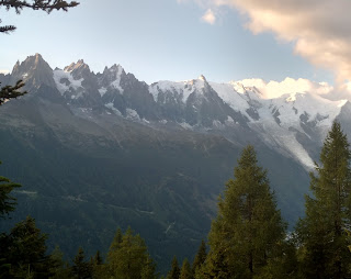
Another really great day. The climb out of Trient was fairly steep but I made good time and passed a lot of people; only a trio of French guys passed me. The Col de la Balme was a surprise for suddenly there were amazing views of the Mont Blanc massif. 


Most people appeared to stop at the col but I continued on into France and the views got even better as Mont Blanc itself came into view for the first time in a couple of days. All the way up and over the Aiguillette des Posettes (2201m) I had this great view and this area was mostly devoid of other hikers. The descent to Tre le Champ was an anticlimax. 

I stopped for a coffee at Tre le Champ and saw the French guys eating lunch. I headed off soon but then wasn’t sure if I had the right path; I saw the French guys approaching and they assured me I was going the right way. I followed them closely but then I suddenly rolled my ankle and stopped for a few minutes. The ankle settled down but I had lost my guides. After a while the route didn’t accord with my guide book and I started going the opposite way to the signs; this proved to be the right thing to do and after three such actions I was back on track.

The ensuing climb to the Tete aux Vents (2132m) was full of hairpins and steep, featuring higher up a sequence of metal ladders and other aids. The area was really busy. At my first ladder there was a lengthy hold up because a large group of very slow people were coming down, but after that it was plain sailing and not at all scary. The Tete aux Vents was windswept and nobody lingered despite the views, but I ate my lunch there. 


I then had a gradual descent to La Flegere refuge which was at the top of a cable car, spotting a snake on the way. There was a massive queue at the cable car station so this part of the trail was obviously popular with daytrippers. The hut was pretty basic but good company, and another very early night with lots of snoring.

Thursday
The weather was clearly deteriorating, with dark clouds from early on but a nice panorama of mountains. I marched along uphill not too far from the people I had eaten with at the refuge. I went a bit wrong, then I saw them go wrong. Then I went badly off course and ended up on a boulder slope which was tricky. I looked back and saw exactly where hikers were turning off the trail I had been on but instead of turning back I hoped I could meet the right route ahead. Of course I couldn’t and almost ended up back at La Flegere, so I had to retrace my path through the boulders and took the missed turning. At that point I realised that I had read about this turning in my guide book and even highlighted it.

The remaining climb to the Col du Brevent (2368m) was stony and away from the high mountain views and during this time there were a few spots of rain. And some pale rainbows. I was checking with everyone coming towards me that I was going the right way, and I asked one group in German because I thought that was what I had heard them speaking; it turned out they were Danish but fortunately I was too focussed on climbing to mention how I had been told that Danish was more of a throat disease than a language. It was amusing asking people where they were going or coming from because of the different ways people pronounced the refuge names. 

The final climb to the top of the Brevent cable car (2526m) was rocky and steep and at the top is supposed to be one of the finest views in the Alps. Not for me. Just cloud. But at least I got the view for part of the approach.


The descent was at first a pleasant amble secluded among rocky hillsides, passing a pretty lake and a hut perched on a cliff. It was a long way down to Les Houches (1007m), my longest descent of the whole hike. As I came into the forest the rain started in earnest. 

I emerged briefly from the forest at a parking area with picnic tables that seemed to be staying dry under some trees and sat there for a while, then went on down. I had put on my pack cover but I wasn’t getting all that wet so I didn’t even put on my jacket. From here the route was harder to follow. I was a bit on the road, back in the forest and back on the road. I ran for a while. Finally I saw the Les Houches railway station and from here it was not far into the deserted town. I stopped for coffee at the first cafe I saw. What’s this obsession with coffee? Answer: the breakfast coffee was never any good. Only Austrians do decent coffee at breakfast.

I stayed at a hotel in Les Houches that was back past the railway station, with a nice view of the mountains except that they were mostly in a swirling mist. (A week later I came through Chamonix on the bus and saw Mont Blanc perfectly from this side. I also marvelled at how high up were the La Flegere and Brevent cablecars.)

Friday
This was the least exciting day of the hike, mainly because of the weather. Les Houches was all in cloud when I woke up and it only lifted a little by the time I was on my way. I had breakfast at the bakery, very nice, then I had a stiff climb on a ski access road up to the Col de Voza. It wasn’t especially high and had a big hotel. Here I had to make a decision about taking the low route or the high route to Les Contamines. The col was completely in cloud so I had no choice but to take the low route. 

The route was a mix of forest trails, farm roads and sealed roads and went through several atmospheric villages. It was all very old, including some tiny chapels. The clouds shifted a little but never properly lifted. I made lots of short stops. Les Contamines was a long village with a few hikers hanging around and I stopped for coffee at the first place I saw. I wanted lunch but it seemed I stopped at the one cafe that didn’t do food (as the owner grumpily responded to my request for a sandwich).

I stayed at a hotel on the edge of the town, but if I were planning now I would go on to the next refuge. It’s a problem with this hike being so popular that you have to commit to your accommodation a long time in advance. I met so many people whose daily distance was dictated by hut availability.

Saturday
I was so delighted to wake up to a perfect blue sky. I marched rapidly out of Les Contamines, passing the church of Notre Dame and climbing on a rough road, built by the Romans I understand, at a gentle grade up to a couple of refuges. From there I ascended through meadows to the Col du Bonhomme where there was a tiny hut and huge views of alpine grasslands and rock faces. There was a group of French hikers paused there who were doing this hike for the seventh time. 

The trail became rocky and scree from here, climbing gradually to the Col de la Croix du Bonhomme. Magic views in all directions and it was going to get better. I continued climbing and reached the Col des Fours (2665m), like a cutting through red rocks. Two sets of French women had brought their dogs up here and they had quite an altercation about the dogs' behaviour. From here you could see Mont Blanc again for the first time in ages but it was partly hidden by the Tete Nord, so I climbed that. One of the dog owners came up also and told someone else in great detail about the poor attitude of the other dog owner.

At the Tete Nord (2756m) was a plaque labelling everything in sight and more. Even Aime was marked! I was pretty close and I could no doubt see the glacier I ran on. Mont Blanc was very clear, actually15 kilometres away, but you couldn’t see the intervening glaciers and lower peaks. I had lunch up there.


The descent from the col was long and steep at first, crossing lots of streams and passing plenty of cows. Everyone seems mesmerised by the cows and stops to take pictures. Some have big horns but they’re all tame, in my experience. I was alone most of the time, heading for the valley far below. I came to a farm road and some deserted buildings, then crossed the river and walked up the valley to my destination refuge. 

Les Mottets was definitely the nicest refuge I used on this hike. It was a former farm with the cowsheds being the dormitories (they had about 40 beds each in a long line) and it was set right up against the mountains. I was given two mattresses in a little alcove along the line so I felt like I had my own room. Across the hillside were hundreds of cows jangling away. There was a great friendly crowd at meals. For dinner we had soup, cabbage salad, meat stew with vegetables and rice, creme brûlée.


Sunday 9 September 
Perfect weather once again. This was the only time to my knowledge that someone saw me preparing my illicit lunch, while he did the same. I set out on the climb above the refuge to the Col de la Seigne (2516m). It wasn’t a difficult climb and the view up there was one of the best. Mont Blanc was very close and there was a romantic vista of clouds hanging in the valley directly ahead. I lingered for a while and even accepted an offer to have my photo taken.


I continued on in the direction I had seen others go, now back in Italy. The path seemed very multi-stranded and I didn’t worry too much which strand I took. After a while I came to extensive scree slopes and on one of these was a patch of ice. I decided it was time to try out my crampons (even though there was a path close by that avoided the ice) and, much to the amusement of a Frenchman who watched me, I walked comfortably across the five metres of ice. The Frenchman continued ahead of me as I sat to remove the crampons and I watched him traverse the scree, climbing steadily. It occurred to me that I might not be going the right way since I wasn’t meant to be climbing and I could see no one who had left the col ahead of me. When I reached the top I learnt for sure I was in the wrong place. The man was still there and I told him where I expected to be; he laughed and pointed out Refugio Elisabetta I was aiming for far away in the valley. However this Col de Chavanne (the French name was a clue that I had erroneously returned to France) was a junction with the local Alta Via 2 (not to be confused with the Alta Via 2 in the Dolomites) which also passes that refugio. So I was able to descend easily and rejoin the correct trail. It was my own 'variante' as the Frenchman said, and I'm sure an improvement on the main route.

From the refugio I headed down the valley and then had another climb through meadows to an outcrop which marked my last high point of the hike. The view across to the Mont Blanc massif, glaciers and all, was wonderful, with just a few clouds hovering. I had this view to my left for hours. There were some marmots, screaming just as they did in Austria. (The first time I heard a marmot scream, on the Adlerweg, I got a huge shock because I was just having a toilet break and I thought someone must have been watching me and blowing a whistle!)


The trail headed down a bit passing lovely round lakes, through light fir forest and then entered the Courmayeur ski area. This wasn’t quite so beautiful. The final out of town stretch was down a very sandy forest trail, quite steep. I could already see Courmayeur clearly. From the forest I emerged in Dolonne which must be the original settlement, judging by its old stone buildings and narrow streets. 

And then I was back in Courmayeur. With filthy legs and shoes from the sandy trail. I went straight to a cafe for a cappuccino and a brioche and looked up at the mountains. The mountain views were so much clearer than when I had left the town eight days ago and the town seemed very lively for a Sunday. I never got the impression that many people start and finish the hike in Courmayeur but it seemed perfect to me. Not only is it the town you would most want to spend time in, for me doing it like this resulted in the less interesting days being tucked away in the middle of the hike.

New blog from July 2020

  New blog I have started a new blog. Not quite sure why. So check it out juliathorn2.blogspot.com