Sunday, 23 December 2018

Wangaratta rail trail part 2

It was hot hot hot for my run from Wangaratta to Milawa to Beechworth and back to Wangaratta this week. I wanted to do the other section of the Murray to Mountains Rail Trail (I did the main trail earlier this year, and I thought at the time that it would also be nice to run to Beechworth). The timing of the Melbourne to Wang train makes it feasible to stay the first night in Milawa with a reasonable run that afternoon.

When I got off the train at 3.15 in Wangaratta the heat hit me in the face. I thought, I can’t run in that! It was 33 degrees. I only took 600 mls of water for what I thought was a run of 16 kilometres. Turned out the trail distances are inconsistently described/marked to say the least. They seem to pick some arbitrary point to start measuring (it’s a secret) and don’t always use the same point. And the maps don’t agree with the trail signs. For the record I ran 20.2, 35.5 and 44.5 kilometres. I feel I must note how stupid I felt carrying a rain jacket and fleece all three days.

I was struggling with the heat from the beginning, allowing myself frequent stops but having to ration how much I drank. I ate all my lollies (not many) at my first stop. It was all very peaceful, lots of cows in the paddocks and not much other signs of life. It was certainly flat. When I got to Oxley I was absolutely delighted to find a little park with a water tap. Despite drinking enough I was still having to take walking breaks for the last 4 kilometres into Milawa. I had a nice evening in the pub. But I don’t think I rehydrated anything like sufficiently.

As soon as I started running the next day, at 7.30am, I was hot. I had hoped for a little time in cooler temps, but the sun was out and there was no wind. I took 1.6 litres of water. The first half of my run was on roads and I had prepared a little map, but it turned out the route was easy to follow. This part was pleasant with quiet scenery and again lots of cows. In my mind the run was divided into pre and past Everton, where I would join the rail trail; for some strange reason I thought the rail trail portion would be easier even though I knew it is all uphill.

In Everton I went into the general store and bought a bottle of Passiona, drinking it almost straight down. I was so hot. Then I had a few kilometres to reach the rail trail. I had a long sit at the trailhead. My day was over as far as my legs were concerned.

I ran and walked the rail trail as best I could, with frequent stops, preferably in the shade. There was no shortage of flies and they bothered me a lot more when I walked. Some of the trail was tree lined and some was totally exposed. Most of it was uphill but the grade didn’t bother me. I only saw two small groups of cyclists. I forced myself to keep going, with reducing stretches of running. When I reached Beechworth I went into the bakery and someone engaged me in conversation, telling me his son was a keen ultra runner, but when I opened my mouth to reply I had trouble getting any words out. The rest of the day I made more effort to rehydrate.

The third day felt to me like it started out cooler. I quite enjoyed the rail trail although it wasn’t all downhill. Strange, that. But once I got past Everton station I again felt cooked. I told myself I only had to get to Bowser, because I thought I could buy a snack and drink at the motel there if I was desperate but even that was 19 kilometres away. I had a lot of stops and ate my emergency muesli bar. There was a lot of debris on the trail - branches and dirt - and not a single bike. I even had a slight tailwind but it hardly seemed to help.

Once I got to Bowser (where the motel did not appear to be functioning) I realised I still had some way to go: 8 kilometres, most of which was on a levee and of course hot. I emerged at Apex Park, the official end of the trail, but I didn’t feel like I had finished; I could either continue into town or go to the station to complete my loop. I walked back and forth across the river trying to decide what to do as I was unsure of the distance for each option (at least this faffing around got my total up to 100 kilometres!) and finally opted for the station, running by the river and then on deserted streets. I was too exhausted to feel much relief at finishing.

Sunday, 16 December 2018

Mt Juliet hike


Last week I got some great hikes done in Tasmania, especially the Walls of Jerusalem, so I wanted to be sure to keep this up when I came home. I picked the hike up Mt Juliet near Healesville for my first hike. Now, I won’t be recommending this hike to anyone because it’s more the sort of hike you do in order to have done it, rather than for the pleasure of the experience, but I’d read about how steep it is and I wanted to see for myself.

Verdict: yes, some parts are really steep, but a lot of parts aren’t so bad. The main thing about this hike is that you get to see a lot of forest, a lot of tree trunks (fallen and upright) and not much else. No views, no clearings, no space for wildlife sightings. Although I saw three disappearing wallabies and a fair few crimson rosellas. There is one section near the top where the mountain ash are spectacular but other than that it’s just forest, some with ferns and some without.  A certain mistiness added atmosphere. 

There’s a disproportionately large summit cairn and a sign at the summit so you don’t continue on (under the false impression that summits always offer views).

It had been raining heavily the past few days so I expected the track to be muddy, but it was merely damp; there wasn’t any mud as such. There were many fallen trees, some quite challenging to clamber over, and some that had obviously been in situ for a very long time. The track is quite overgrown so I was constantly pushing wet branches out of my face. For this purpose my hiking poles proved invaluable.


I was alone on the ascent, over 900 metres in about 5 kilometres, and on the way down I only passed two hikers. From my point of view this was good because I was sure I was going to be slipping over and falling on my descent and I didn’t want spectators. But I didn’t fall once, although I skidded a few times. The  descent was not as difficult as I expected, and after I completed the steep sections it was really easy going. I arrived at the end of the hike feeling completely relaxed and fresh.

Sunday, 9 December 2018

Bruny Island Ultra 64 km, 1 December


I had a busy November and I kept going until 1 December just to be sure. In November I did Carcoar Marathon, Marysville 50 km, weekend off, Lilydale Marathon and then I ran the Bruny Island Ultra 64 km on 1 December to end my year of races.

Bruny Island was a bit different from other ultras in having only two (very modest) aid stations on the course so we had to bring our own support. I took Dom. He drove while I ran, and we met up at intervals so that he could hand me lollies and drinks. Most of the field is made up of teams whose members run segments of the course which can range from two kilometres to doing 32 km each as a couple, or any variation in between. So it’s a fully supported relay race with a contingent of solo runners.

I was nervous about how it would be to run with so many cars (one per solo runner and often several per team) sharing the road, whether I would spot Dom among the support vehicles and whether he would spot me. In the end none of these became issues, the cars didn’t throw up too much dust on the dirt roads and I didn’t feel as though I were running in heavy traffic. Although there was a bad bit of snarl up as I approached the lighthouse right at the end of the race where I had to weave through the cars. And as we drove away from the finish after the race this problem had become much worse with the cars unable to move forward or back and the runners having almost nowhere to run (or walk).

A great deal of the route was on gravel roads and almost none of it was flat. The hills were gradual and longer in the first, northern, half of the course and shorter but steeper on South Bruny. I was keen to see how long I could run without walking and I didn’t walk until after 52 km. Not sure if this was wise, but even then I only walked a little. 

You have to nominate your own start time for the race, based on finishing between 11am and 2.30pm. It’s hard to pick a start time without knowing the course but I thought eight and a half hours should be adequate and I ended up starting at 5.45am. When I checked in at the start I was surprised that 3/4 of the solo field had already started. I got passed by several runners early on, which made sense as they should be faster, but this also suggested I had started too late for my pace. I hardly saw any of the solo runners until much later on when I picked off a few. 

I strolled down to the start at the pier in Dennes Point at the top of North Bruny Island and got going. Daylight was well under way. There was an immediate long uphill and at the top a great view of little islands and bays to the east. It promised to be a lovely day although still quite cool. Ups and downs followed and I got into a rhythm as I progressed alongside farmland. I saw Dom at the 12 km point and from then on every six kilometres. Crew were permitted to stop every two kilometres and I found if handy to look forward to these points even when I ran through them, as the supporters were friendly and these short chunks of distance gave me something to focus on. I tended to see the same team support crews at each stopping area so we established quite a rapport. It was just peaceful pastoral scenery with a lot of sheep.

Close to the Neck, which links North and South Bruny, we were again by the water and had a bit of flat. My stomach was playing up, unusually for me, and then my left foot started to hurt. I tried to push through. The foot pain went away but the stomach issue remained. I think it may have been the horrible tap water at the place we stayed. The Neck was an impressive sight, lots of water on both sides of a narrow causeway.

South Bruny had more civilisation than the north and I was keen to see what the small town of Alonnah would be like. Actually it wasn’t much but there was a small aid station with cups of Gatorade and a huge bowl of lollies at the 40 km mark near the island's only pub. There was also a suggestion of more hills. The road was sealed for a short while then went into forest and was gravel the rest of the way. There were stretches of farmland and another small settlement, Lunawanna, where there was an impromptu aid station with water and Gatorade by the community hall. I grabbed a bottle of water since until then I had been drinking exclusively sports drink (because I thought that we had only brought the awful tap water in our water bottles). 

In the final kilometres I had to dig deep but I was also pleased to be passing people. It may not have meant much because they would have started before me and intended to run slower but it felt good. I walked a few of the steeper hills and Dom was meeting me every four kilometres. Kms 58 to 60 seemed the shortest of the day as there was a long steepish downhill, but the ground was sometimes a bit slippery due to the crushed gravel surface which was very dry. The day was warming up.

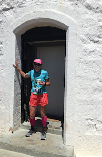
Around 62 km I had my first view of the lighthouse, my destination. It was perched on a hillside, of course, lighthouses are not generally on the beach, but it looked far more than two kilometres away. So I greeted Dom at the 62 km aid point with a big expletive. Actually it was about the right distance, although I had to fight through cars to get there. By the time I reached the final push Dom had parked and was walking towards the finish; I saw him just before the final hill up to the lighthouse so we did this bit together. This was tricky as the narrow path was also the only way to leave the lighthouse for runners and crew. Full teams of runners in some cases.


It was great to finish. Lovely views in all directions of bays and beaches. Beautiful lighthouse. I forgot to turn off my watch because I’m not used to wearing one, but I found out later that I ran 7 hours 18 minutes. 


After a short while we went to Cloudy Bay to relax on the beach and then back to the pub in Alonnah for chips and beer.

New blog from July 2020

  New blog I have started a new blog. Not quite sure why. So check it out juliathorn2.blogspot.com