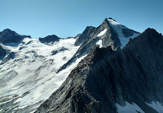
Monday, 30 September 2019

Grand Trail du Sancy 60 km trail race, France

After my experience at the surprisingly difficult Dents du Midi race last weekend I became a bit too anxious about this weekend's race, Grand Trail du Sancy 60 km at Le Mont-Dore, France. Last year at least 20 percent of the field didn’t finish, presumably having missed cutoffs, and the results looked almost as frighteningly slow as those from the Swiss race. In an attempt to calm myself I got a piece of paper and superimposed the elevation profile of the Sancy race on top of the Dents du Midi using the same scale: the French race had five climbs as opposed to three but they all involved considerably less elevation gain and the finishing descent was half the vertical drop of the Swiss race. This cheered me up somewhat but I still calculated I would have to maintain at least the pace I had run in Switzerland in order to manage the 50 km cutoff; maybe not too hard as the course should be easier, but my legs would be more tired this weekend. I had done two short runs and two short hikes in the week.

On top of this I had foolishly entered the 12 km race on the Saturday as well (there was a full weekend of races), thinking that I usually get a bit bored the day before a race, but that just made me more anxious as the 12 km race started at 2pm so I wouldn’t have a full day of recovery before my main start on Sunday morning.

The 12 km race went fine and I took it as easy as I could within the constraints of it being a race so I wanted to do ok. It was warm being the middle of the day. It was handy to see what the local terrain was like. I won my age group and they made a big thing of the podium so that was fun. Unfortunately for my pre race nerves, though, the person presenting the prizes said that we had been lucky to have good weather for this race (I had not seen a single cloud all week) but we were guaranteed not to have good weather on Sunday. A blow. And then as we stood on the start line on Sunday the race director said that they were expecting storms in the afternoon and would be bringing the cutoffs forward, but he didn’t say by how much. Not good at all.

We started at 5.30am in the dark, running through town and into pitch black forest. The temperature was great: cool, although quite humid. I ended up having a runny nose all day which I seemed to be perpetually wiping. I realised immediately that my head light was useless, giving almost no light, and I relied on runners around me for light. We had a stony but fortunately wide trail, and I was mostly ok when going on the flat or uphill except when a person was right behind me and consequently put me running in my own shadow so I could see nothing ahead. I had a real problem running downhill as I was slower than surrounding runners so I couldn’t latch onto someone else's lighting. Eventually I found a group I could keep up with. First climb done and not too bad. And by the end of that one it was pretty much daylight. We ran through a hamlet I recognised from my hike a few days before.

At the first aid station I had coke and slices of Madeira cake. They had cheese and salami too but I had eaten enough cheese yesterday after the race. I had stood at the food table after the race eating bread and cheese until I couldn’t any more, and then I won a slab of cheese as my age group prize. So I was quite over cheesed. 

We came through the edge of La Bourboule where I had stayed a few days 

and then started our first big climb. I was determined to walk hard and passed lots of people. It was too steep to run but I could hike fast. We crossed grassy hills and were on a stony/earth trail, braided and narrow, and it was easy to lose balance in the grooves so I stumbled a lot. Near the top were good views of rounded mountains and towns below. We had a long but not too steep descent, but the earth parts were slippery so I ran on the grass edges where possible. Needless to say lots of runners flew past me. But not so good for some of them: their shoes filled up with dirt and they had to stop to empty them out so I easily passed them at the bottom.

At the beginning of the next climb a spectator was telling us all our race position as we went by; I was 546th place. I wasn’t to know this at the time but fewer than 546 runners finished. This was a longer climb and again I was able to pass many runners. I saw some odd rock formations, distant higher craggy mountains, cows and horses. There were several false summits. It was still quite cool with  patches of blue sky although I was disheartened to see dark clouds in the distance. The sand on the path was sometimes blowing around in my face. It had been windy yesterday in the 12 km race too; at the aid station I had picked up several slices of cheese and they were all coated with sand so didn’t taste great.


I was feeling quite good and after the 30 km cutoff point I became a lot less worried. At the third and final aid station, after 40 km, we were suddenly joined by masses of runners: this was the 19 km race. As a result there were a couple of big bottlenecks at two stiles. At the first one I slipped around the side, but the second one required a long wait. We were then in a long conga line; the path was generally braided so I was often able to pass, and many runners were saying Bravo soixante. This mass of people was a bit frustrating but I took comfort from the idea that they couldn’t cut this many runners from the race. 

Then after climbing for half an hour the 60 km runners were being sent in a different direction. On the one hand this was a huge relief but on the other hand I felt like a straggler as I barely saw anyone as I ran forever downward through the forest. I saw a group of runners clustered around a van in a clearing at the bottom and became alarmed that the van was part of the cutoff system, but then I realised this was a water stop. This was also the final control point according to the website and I sought reassurance that I would now be allowed to finish; I was informed that the cutoff had  already been imposed behind me at the point where we split from the 19 km runners.


We began the climb to Puy de Sancy, a solid climb in forest with many big rocks, then out onto more grassy slopes to the highest point of the course. This area was desolate. It was cold and windy and then the forecast rain started. I put on my rain jacket. The surrounding peaks were all in cloud and soon we were in cloud too. The rain turned to sleet and I was very cold, only feeling ok when sheltered by nearby slopes. This final part was tough as not only was I really cold but nor  could I see where the path was leading or where the top might be. Luckily I could always see other people hiking ahead and I was still passing some. I had many This will soon pass moments, and was very pleased when I reached the top of several converging chairlifts and decided this must be the summit (or at least as close to the summit as we were going). There were no marshals there which I felt was odd, but 100 metres later I came to a small water aid station where they were checking bibs; they assured me the rest of the way was downhill. Of course it wasn’t, this was a bare faced lie, but there was only a tiny bit more climbing.

The six km downhill that followed was on a wide stony trail, at first clearly a ski trail. The rain had damped it down so the earth was not so slippery, but soon the trail had a river running down the middle on the most runnable part and it became impossible not to get my feet soaked. At least I knew it was not long to the finish. It was great to emerge from the cloud and the brightness of the light startled me but it was still raining moderately hard. At first the scenery was mostly ski lifts and cabins. I passed lots of stragglers, mostly looking as I felt - bedraggled. I came into forest and there the entire path was a river. 

It seemed a long six km and not made any easier by the way that French hiking signposts seem to like repeating themselves as you move down the trail so we had three km to go for several kilometres. My feet were freezing cold and I couldn’t feel my legs at all or tell if I still had my shorts on, but suddenly there was a window in the forest and I saw that the town was close. I should have recognised the final kilometres as they were the same as yesterday’s finish but I didn’t until the very end and even then I misremembered the final few metres. The last bit was really steep and slippery on loose stones yesterday but was nicely damped down today. I thought I had to run through town but once out of the forest I turned and was immediately running into the finish chute. There was nobody much around because of the rain which was kind of disappointing because the French are usually so enthusiastic on finish lines. I happily waved my arms above my head, poles in each hand, but there was no photographer, because of the rain.

The post race meal was aligot (sausage and mashed potato), definitely the best post race meal ever. I had my beer and then collected my age group prize with my ten hours and nine minutes:  another block of cheese and a selection of teas, just like yesterday, but they didn’t have a podium ceremony because of the rain. I had finished 22nd female and in 322nd place overall which meant I had passed a great many people since the man told me I was 546th. About a quarter of the field didn’t finish. I gave my teas to the woman who had checked me into the race and she gave me a big hug. Once I got back to my hotel room I didn’t do much; it rained all evening so I lay on my bed eating chocolate and cheese.

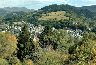


Dents du Midi 57 km trail race, Switzerland - 14 September

Descent from Col du Jorat
This race, 57 kilometre Dents du Midi Trail, a loop around the Dents du Midi mountain range starting and finishing in Champéry, Switzerland, was something of a shock to me. I had entered it because I wanted to do a race on my birthday and it sounded nice. I presume I must have looked at the race results at some point before entering or at least before I left home, but when I looked at them a few days before the race I was extremely surprised by the very slow finish times. A majority of the field had taken more than 11 hours to finish. The race appeared to have three major climbs, and with all the hiking I’d done I knew what a climb of 800 - 1000 vertical metres was like. Couldn’t be that bad I figured. I ran a vertical kilometre during race week and it was tough but not impossible. 

I hoped to finish in under 12 hours so I could go to the cake shop next door to my hotel before it closed at 6.30pm and I planned to have a blueberry tart heaped with blueberries that I’d seen, coffee and two scoops of ice cream. It was my birthday after all.


Our first hour, with a 6am start, was in the dark but with plenty of moonlight, along the river, then we crossed it and started to climb. I had thought this would be a monster climb since it was long and interspersed with short downhills; I can find short downhills on a long climb to be somewhat dispiriting. In fact I had expected this to be the hardest climb of the day. We were in single file and it wasn’t very steep, through pastures on fairly smooth trail with many creek crossings that were a bit yucky and slippery. There was a great view of La Haute Cime, the highest peak of Dents du Midi. After a climb of about 12 km we had the first aid station at Soi next to a mountain hut which had Rivella (my childhood favourite), cheese, chocolate etc. So things were looking good.

We had a long descent to the town of Verossaz and another aid station. Mostly I didn’t find the descent too bad as it was on wide paths, roads and just some bits of slippery grass, so I was pleased about that, as I had been so worried about the race’s descents.

I had been been running until now close to a group women but after the town I never saw them again. For a while we were on gravel roads and level rocky paths, then we climbed in forest to the  village of Mex and ran downhill on its cobblestone narrow streets. It was a really pretty village in true Swiss style. The highlight (just joking) was a water trough in the village where, thankfully as it transpired, I had three cups of water. I still had no idea what lay ahead. After 4 -5 hours had passed I was over half way so I thought a 10 hour finish was very possible. The mountain atmosphere was great and the views were stunning; at several points I could see all the way to Lausanne and the big lake.

From Mex we were on a wide trail and I had a toilet break. This was also lucky because I saw nowhere else suitable for the rest of the race. In a while we turned off the wide trail onto a narrow, steep and stony trail. The gradient was a shock. I took it steady and eventually the grade eased. I passed another water trough with lots of runners clustered around but I didn’t stop as I thought the next aid station was not too far away. Big mistake. I had water on me but the aid station was not at all close. 

I could see a hut ahead and assumed this was where going but we soon passed it. I became worried because the col we were headed for was at 2200 metres which is well above the tree line but I could still see trees growing much higher above where I was. Then I was able to see people way up above, tiny ants on a zigzag trail. It looked horrifying. The terrain was grassy above the tree line and the path steepened again. There were rocky interludes. It became really hard going. People were stopped doubled over. Sometimes I stopped involuntarily, took a deep breath and told myself to keep going. I overtook many runners just by moving constantly but slowly. Some of the elite runners who had started three hours after us came past, also hiking. (I was in the so called citizens race.) My heart rate was through the roof. I stopped once to eat a bar and I drank a lot. I told myself I would make it to the summit just as I would make it to the finish, and I reminded myself that I had wanted a race that would take all day. 

Finally I saw a big wooden cross that marked Col du Jorat. And I made it. About 30 runners were sitting around on the grass. We had climbed a vertical kilometre in five km, including the flatter part at the beginning. The view of the lake by Salanfe mountain hut below and the mountains beyond was wonderful.  After a short sit I started the descent to Salanfe hut and enjoyed a break at the aid station. 

I thought I would be able to run the next level stretch along the lake and then across rough terrain towards the mountains but I could barely move. This seemed to be the same for everyone else. Then the next climb started. I kept telling myself it was nothing like as long as the previous one but it was much more rocky, with big steps up. Again I tried to just move forward and passed many. I saw some people standing on rocks way above me and I thought they must be spectators. But no, we had to go there and then some. Actually we had to clamber over those rocks and go up a narrow chute. Then I searched for an opening among the peaks that would be the col. Couldn’t see one and I realised we had a long way to go. We had long zigzags on scree, not the big Austrian scree but very small pieces where you keep sinking in. Finally I came to Col de Salanfe at 2600 m. This was a climb of 600 metres in three km. This time nobody was sitting around despite wonderful views back towards the lake and in the direction of Champéry.


The marshal up there said to me that it was all downhill from here. He was entirely truthful but the descent was horrible. Really horrible: loose stones, steep, abrupt turns, and the path was often in a groove and so narrow that it was hard to run in it. I went really slowly, so slowly that I felt stupid, but I was fairly scared. Lots of the runners I had passed on the way up skipped along down as if it was all great fun. I could barely believe how fast they would be out of sight ahead of me. 

On the way down there was an aid station at Susanfe mountain hut and then the awful descent continued on the Pas d’Encel. This had been mentioned in the race notes but the full importance of the warning had not sunk in. I went like a snail, coming to a standstill frequently, and masses passed me. It was such an amazing wilderness area but so hard to traverse. There were long stretches with support chains but I’ve learned that Swiss chains are useless because they are so slack that you can’t put any weight on them. You could be hanging onto the chain and still be half way down the mountainside. Some of the bare rock was very slippery and some was made slippery by being coated with a thin layer of mud. I could see Champéry far below but didn’t hold out much hope of getting there any time soon.

The path evened out and contoured grassy hillsides and I relaxed but then after another mountain hut at Bonavau I went into forest. I had not been looking forward to this because I knew how the forest trails were muddy, slippery and with lots of foot-snagging tree roots. This was awful too, slippery roots and rocks, muddy and really slow; I panicked every time I slipped as my legs were so tired. Occasionally I came onto nice 4wd trail but always returned to forest. I muttered to another runner that it would be better if we stayed on that trail and he laughed. Finally I came to the base of Grand Paradis ski lift. Now it shouldn’t be too far. I could see the limestone shelf in the mountainside across the valley that I could see from my hotel room.


I crossed the river and realised I was retracing my opening kms. I started passing houses and just hoped this was Champéry. There were small groups of people standing here and I could have asked them where I was but that might have sounded silly. Funnily enough I was able to run well now. Very suddenly I passed the first restaurant of the main street in Champéry and knew I was almost done. Crowds were cheering all through the town, the amount of support was astonishing. I had a huge smile on my face. I loved the finish, and I had indeed broken 12 hours with my 11 hrs 52 mins. I clocked the race at just over 60 km. As I neared the finish I glanced across to the cake shop and it was closed.

After I finished and had eaten my nondescript meal of pasta with mushrooms and had a beer I saw that I had won my age group so I hung around for the prizegiving. They did the women first and I got to stand on the podium, all alone as nobody else in my age group had finished yet. Everyone clapped, then I told the race director it was my birthday and when he told the crowd they all clapped again. My prize was a nicely wrapped basket of salamis, terrine and speck. 

All the restaurants in town were extremely busy but I got a seat at the bar at the one I had earmarked. I had two Aperol spritz, burger with salad and fried potatoes, and small ice cream. I had to keep standing up because it was so uncomfortable having my knees bent. Every now and then there would be a sound of cheering from outside and it was a runner finishing. I had by no means come in last. 

I certainly enjoyed getting into bed that night. The race was great and I would do something similar again, especially as this time I would be forewarned. I think the nature of the course was a big surprise to me but now I’ve had experience of a few of these European alpine races I know what I should investigate before I sign up. I’m not too shabby at climbing but I am hopeless with long technical descents and I need to avoid getting involved in these.

Adlerweg, Austria 2 - Innsbruck to St Anton


August 31 Innsbruck to Leutasch 28.1 km 1670 m ascent. This was a really good day with an unsatisfactory ending. I expected it to be one of my harder days because I was doing two sections plus lengthening the second one. After a great breakfast at my four star hotel I took the train from Innsbruck to Hochzirl as part of the official route then had a steady climb to Solsteinhaus, first in forest and then on open hillsides. At first it felt strange to be returning to the Karwendel mountains after being in the city. Solsteinhaus was on a hilltop in a lovely grassy area and I wanted to linger but I had a long walk still ahead. So I continued on up to Eppzirlerscharte, going steeply up on scree. When I looked up there was a lot of climbing to do on switchbacks but I made it ok. I was worried about the steep descent on scree. I sat for a while at the notch enjoying the blue sky and views into the valley. There was a group of hikers sitting there and every one of them was smoking. The descent was not too slippery and I passed many people struggling uphill. At the end of the descent I sat at an alm to eat lunch and then continued down the valley. Looking back up at the notch I was amazed at how high up I'd been. The rocky outline of the mountain range was really beautiful against the blue sky. 

I had to walk six kilometres down the valley alongside a creek and then I came to the ugliest place I’ve ever seen in Austria: derelict railway yard with skips, vicious dogs, weed infested path. 

The next part seemed to be a climb for the sake of it, on a 4wd trail which went constantly up and didn't match my route notes. Finally I reached a saddle as I was supposed to, but not before I had stopped other hikers to ask if I was going the right way. Just as I started down I heard thunder and then the rain started, and it became heavy. I followed the downhill trail fast to the river and the start of the spread out town of Leutasch, which is another ski resort I haven’t heard about. From here I had to walk along a sealed path by the river for three boring kilometres and by the time I reached my hotel I was exhausted and hungry.

At the hotel they said I couldn't get food there because I wasn’t on half board, which was extremely mean of them as the nearest restaurant was 20 minutes walk away and it was still raining hard. When I went up to my room there was already a couple installed there; the reception girl didn’t believe me and went up to check for herself, with me in tow. She addressed the couple as though they were criminals and after a long wait, when I had to sit watching the guests on half board eating dinner, I was given the room next door. I came downstairs again to ask if I could get a snack (answer was no) and I noticed some loaves of bread on a sideboard in the dining room so I asked a waitress if I could cut some bread for myself. After a brief discussion she said I could so for dinner I ate three slices of walnut bread with the jam I've been carrying in my pack since St Johann.

September 1 Leutasch to Ehrwald 22 km 571 m ascent. The next morning I was keen to eat but I was chastised by a waiter for coming to breakfast at 7.20 when it started at 7.30. Funnily enough I don’t get the impression that the Austrians choose to go through life without food. Today was billed in my guide book as an easy day and I was glad because I was still tired and actually in need of a break from hiking. The day turned out more pleasant than I expected. A thunderstorm was forecast from mid morning onwards. I walked through meadows and light forest along the river, surrounded by high rocky mountains. I stopped at the first alm I came to for cake, just in case the storm would prevent me from eating later. I passed a lake in a grassy bowl. Finally I came to an alm below Zugspitze - I could hear Austrian drinking songs as I was walking along - and I sat at the alm for a while. So I got to see Zugspitze finally after three days of cloud in Garmisch last year (quaintly, the Austrian/German border runs across the summit). My last few kilometres were downhill under a ski lift to the compact town of Ehrwald. It was altogether a nicer ski town than Leutasch. I was pleased to find several restaurants within easy walking distance of my hotel; I went into the first one I saw to ask them if they would be open in the evening as I didn’t want any more surprises. It wasn’t all perfect though: at 5pm it started raining and I had to go and get my dinnertime pizza in the pouring rain.

When contemplating the next day’s hike I realised that I had a major problem, actually two major problems: the first hut I was intending to stay at (no warden on weekdays and without kitchen) might turn out to be locked when I get there and if nobody arrived with a key I would have nowhere to sleep safely and warmly; the next hut, a day’s walk along beyond that one, was closed for renovation and there was nothing else anywhere within many kilometres. Plus the weather forecast was awful. So, again, I spent hours trying to work out what to do and finally came up with a plan that involved two buses. This was the most glaring example of many that showed how the Adlerweg has not been thought out with the thru-hiker in mind!

September 2 Boden to Hanauer Hütte 5.4 km 572 m ascent. The weather was indeed dreadful when I got up and Zugspitze was not on show. I executed my new plan of two buses to Boden via Imst, where it hadn't rained, and I had to spend two hours at the bakery waiting for the second bus. There were several groups of hikers on the bus to Boden so I anticipated my hut that night would be busy. I felt sick on the hairpins descending to this tiny village.

 It was raining again by the time I started my short hike to the hut and I soon walked up into cloud along a raging creek but I definitely had my hiking mojo back. I could see the telpher line to the hut but maybe it was a good thing I couldn't see hut far above me. The hut was extremely busy as that morning’s hikers seemed not to have left yet while all the hikers off my bus got there too, but it had a better atmosphere than some.

September 3 Hanauer Hütte to Württembergerhaus 16 km 1240 m ascent. I woke up to a perfect blue sky. How does this happen? Such major changes from day to day and I never knew it was coming. Now I was going to be spending several days on the Lechtaler Alpen Höhenweg, most of which involved difficult but short days. Today I had four passes to cross, all with steep climbs and tricky descents. I went around a series of beautiful cirques, no sign of civilization at all, and all above the tree line. There were small patches of snow, tiny creeks, almost no cows. I spotted some sheep really high up and some horses by a lake. From the first notch the view was not great until the descent, where I had a truly amazing view of little Steinsee with cloud hanging in the valley around the lake.

 Then I had more views of hanging clouds and layer upon layer of mountains on the horizon - I think these were the higher parts of the central Alps to my south. 

I went up and through the next easy notch and then enjoyed long contours around another cirque with velvety grass. I climbed and scrambled to Rosscarscharte then had a difficult descent on very slippery steep scree; at one point I fell to a sitting position and couldn't stand up so I continued down like this but I could see a hiker coming up and I knew I must get through the cable section before he started on the cable. The cable was fairly useless actually as it was not attached at the bottom end. The last climb was to Gebäudjochl saddle and from there I could see Württembergerhaus below but again there was an awkward descent between big rocks and then endless zigzags to the hut. At the hut I sat in the sunshine with high rocky mountain faces virtually in touching distance and finally had kaiserschmarrn. 

September 4 Württembergerhaus to Memminger Hütte 9 km 615 m ascent. This was a short but truly great day, for weather and for hike quality. It was cold at first. After reading about the day’s hike in the guide book I was worried about the difficulty but it was fun. I started with a steepish climb to the top ridge of the Lechtaler Alps and as I sat resting I saw several ibex on the scree nearby. I walked along the ridge with fabulous views on all sides; the trail kept switching from side to side on the narrow ridge. The lengthy descent involved crossing many side ridges then I had a steep ascent to a notch. As I came through the notch I was treated to the unbelievable sight of grassy mountains, two azure lakes and Memminger hut. 

Although I had just had a long sit before reaching the pass I had to sit again for the view. I had a gradual downhill to the hut in a grassy bowl. 

The warden was happy to check me in and chat with my simple German but then she asked me something I could not for the life of me understand and she resorted to English: had I sent my pack up to the hut in their goods cable car? Well, honestly. Anyway, the cable car came up from the other direction. The hut deck faced perfect mountains flecked with snow, velvety grass on the lower slopes and it was hot and sunny. 

I became exhausted with all the beauty and I had to go and have a nap while the dorm was still empty. I was one of the first people to arrive at the hut but later I watched dozens of walkers coming down the hill from all directions. This included a group I had seen every day since Boden, who told me there was bad weather on the way and that they were concerned about the next section of the hike. I had a germknödel with custard for afternoon tea and split pea stew with frankfurters for dinner. 

September 5 Memminger Hütte to Ansbacher Hütte 11 km 1022 m ascent. Just after 5am everyone started getting up, which meant bad weather really was coming, and I had to queue for the 6am breakfast start. I was on the trail at 6.45. No more blue sky on the Adlerweg for me. The mountain tops were in cloud already. I had a long descent of three km to a river crossing, on the way crossing a ravine with high vertical walls, then a very long climb, and by now it was raining lightly. I was soon in cloud. I saw nobody coming up behind me and it was very peaceful. Then I started climbing steeply on rocks and boulders and I heard, then saw, two groups of hikers. I stopped to chat with the English group. I had by now made a vertical gain of 900 m which was followed by a cable assisted climb through a vertical chute, probably the hardest climb of my hike: about 100 m of pulling myself up on jagged rock. Then it started to hail. I continued up to the next col but that one seemed easy. It got very windy. I could sometimes see the outline of the nearby mountains. 

When I reached Ansbacher hut it was only midday but I decided to stop. The warden was very friendly. At first the clouds were swirling and I got some views down to the valley but it rained all afternoon and the views went. It started snowing at 5pm and I stared out the window in amazement then went and asked the warden if that was really snow, but he was not perturbed at all (neither by the snow nor my question). The group I had been seeing since Boden never turned up.

September 6 Ansbacher Hütte to Kaiserjochhaus 13 km 1143 m ascent. There was lots of snow overnight and zero visibility in the morning; I was initially worried I would have to stay at the hut all day so I was pleased to see others venturing out, although there was no question of doing my planned alpine route to Kaiserjochhaus. I followed others downhill to Schnann village, the one I'd glimpsed in the valley yesterday. There was snow on the ground for the first 20 minutes. It was all downhill in forest with the typical twisting and turning. I walked through Schnann and then through Pettneu on a footpath by the river and decided to try going up to Kaiserjochhaus. This could prove to be stupid but there was nothing to do in the villages and it would mean I could complete the Adlerweg as I had intended. 

The trail was straight uphill for 1100 m ascent over six km; I was glad it didn't mess around. First I was passing many pasture huts, then I went into dwarf conifer forest, then I was on open grassy hillside. Only the final 1500 m was in cloud and light snow lay on the ground in the last 700 m. I was following a stream the whole way, mostly easy but wet underfoot, but the air wasn't cold. I got to the hut up at 2310 m by 1pm which was a great effort, and it was lovely and warm inside but there were no views to be had. As compensation I had kaiserschmarrn which had whipped cream on the applesauce and came with jam also. I went to bed at 7pm, while it was raining, and the rain had washed all the snow away.

September 7 Kaiserjochhaus to St Anton am Arlberg 11.7 km 369 m ascent. It was snowing when I woke up and had clearly been snowing all night. 

Nobody thought my intended route would be a problem but as usual in poor weather nobody else was going my way.
 The path was easy to see, the painted signs very visible and I can only assume the paint they use must be snow repellent. I did some walking in fresh snow. 

I had left the hut in cloud but soon I descended into a grassy bowl with good visibility of snow streaked mountains. The highlight was seeing a group of eight chamois run across this bowl. I stopped at Leutkirscher hut briefly, it was still snowing but there was no snow lying, and then I had drizzly rain. I descended in light forest and over grassy slopes and could soon see St Anton in the valley. A few people were walking up. As I came into town I saw a couple with Bäckerei Ruetz bags so I had to find this bakery. It was in a large car park and busy; I was able to dry out a bit and then had a chocolate donut and coffee. I walked across town to my hotel and thereby completed my hike across the Tirol. 

It was a good feeling. I did very little all day beyond lying on my bed, buying bread and cheese for a picnic dinner in my room and eating some of my emergency chocolate rations.


Sunday, 29 September 2019

Adlerweg, Austria 1 - St Johann to Innsbruck

Zireinersee
Having walked the short section of the Adlerweg in East Tirol last year I decided to go back this year and hike the main part right across the Tirol which is much longer, over 300 kilometres, from St Johann in Tirol to St Anton am Arlberg. This time I had a guide book and had researched the route more thoroughly. I had worked things out so I could stay at a mix of hotels and alpine huts; I had only booked a few hotels and was intending to arrive at the Alpverein mountain huts without any reservation so that I could be flexible from day to day. (It is so hard to know in advance how far I can hike in a day because everyone’s idea of difficulty varies, and also I had a hunch that the weather would not be as good this year as it was last year.) This is apparently ok to do when you are an Alpverein member like me. What I did not realise at the time was that the route has changed since the guidebook was written and some sections are downright tricky to access and hike and some of these amended parts of the route do not have Alpverein huts. So I had a few anxious afternoons in Austria when I had to make changes to my itinerary on the fly. I was really surprised not to meet anyone else hiking the whole Adlerweg or even doing sections or even mentioning it especially as there were posters about the hike at almost every hut.

August 23 St Johann in Tirol to Pension Maier 28.2 km 1608 m ascent. It was a muggy socked in day as I left St Johann and walked through several surrounding villages to reach the official start of the Adlerweg at an alpine hut called Rummlerhof. The start was marked by a series of boulders each bearing the name of one mountain range that the trail passes through. I was starting with the Wilder Kaiser range where I have skied. I went in light forest up to a big cave and on to a waterfall that I had to walk behind and where lots of climbers were scaling the higher cliffs. I had a lot of uphill through meadows but no view due to the foggy day. I stopped at Gaudeamus Hütte which was really busy and when the weather temporarily cleared a little I could see impressive dolomite mountains towering above me. But it was too early to spend the night there so I just ate my lunch.

At this point I had to decide whether to follow the new official route (which my book described as a variant) going higher up or to stay on the old route lower down. Since I didn’t think I would see much higher up I kept to the original route but this meant I had to find somewhere to stay as there were no Alpverein huts on this section. I phoned a few places and Pension Maier offered me a bed. There was only one problem: after I finished the phone call I thought I should look on the map to see where Pension Maier was, and it appeared to be several kilometres off the route. 

My afternoon hike was nice, climbing in forest and then going along the edge of the mountainside, crossing several scree landslides and meeting no other hikers for hours. I then had a long descent to Hintersteinersee where I tried to find somewhere more convenient to stay. Everywhere was full but one guy recommended the place I had booked, which was a good sign; I wasn’t sure what kind of place it was from the phone call but it was closer than I expected. The lake was surrounded by forest and I walked the length of it fast as I could feel my energy reserves running out. Pension Maier turned out to be a busy hostel, more like a pub in character. I was also pleased to find that it was actually on the new route so I was not making a detour. I ate my first schnitzel of the trip and I was worn out.

August 24 Hintersteinersee to Kufstein 16.4 km 664 m ascent. It was a beautiful day at last. I had a steady 5km climb to Hochegg with 360 degree views and I was fairly sure I could distinguish Grossglockner roughly where it should have been. Mostly I could see forested limestone mountains. I had a winding descent through meadows to a tiny settlement with a cute chapel and then forest with window views. At Ashenbrenner Alm I had a coffee looking down on Kufstein then I continued down to the town alongside many mountain bikers. I know Kufstein well, and by mistake I initially tried to check in at the hotel I have stayed at before whereas I had booked to stay at the hotel whose restaurant I had liked before. 

 At this point I realised I had a problem with accommodation for the next night as I had planned to stay at a private gasthaus but I had forgotten to book and when I phoned it was full (and the owner wasn’t in the least bit helpful), and it was the only accommodation in the area. I spent the whole afternoon trying to work out how to do the next stage of the route and in the end I resorted to phoning the unhelpful gasthaus owner for a second time; I was able to establish that buses came to that area (although on Sunday the bus only came to within a few kilometres which was a shame as I was going there on Sunday) and I managed to work something out finally. In the late afternoon there was a thunderstorm but I was safely in my room making phone calls and searching for bus timetables. 

I had Tiroler groestl for dinner (too much salty meat), and I managed to act as an interpreter when a French man ordered some wine and could not understand when the waitress told him (in German and in English) that it was wine mixed with lemonade. The man’s wife said I had saved their life which I felt was understating things a bit.

August 25 Pinegg to Langkampfen 25.1 km 945 m ascent. This was now the Brandenberger range. I had to be resourceful to get this portion done but my plan worked well. I took a train and then bus to the hamlet of Pinegg and then walked two Adlerweg stages back towards Kufstein and stayed again in Kufstein. Pinegg to Buchacker Alm was along a river with a gradual climb; there were lots of bikes but no hikers. Then I undulated upward through meadows. It was hot and muggy. Near the top there were suddenly lots of hikers, maybe because of a cable car nearby. I had soda water with lemon at Buchacker then moved on to the next stage which was mainly downhill. I had a good view down to the Wörgl train tracks (Wörgl is a big junction I’ve been through many times). Thunder started while I was on my way down. The undulating trail had a lot of switchbacks, cows, mountains in the distance and the sky was black. 

There were no hikers as I came down. It rained a bit off and on and the thunder continued. I found it tiring, maybe due to the heaviness of the weather. I had a steep descent in forest (lots of leaf litter) and got to Langkampfen station, which was strangely about a kilometre out of the town in the middle of the fields. The trip to Kufstein took five minutes and is part of the official Adlerweg. 

August 26 Aschau to Erfurter Hütte 17.7 km 1457 m ascent. This was a great day, starting with a sunny morning. I took the train and bus to Aschau (very close to Pinegg) and resumed my hike in the proper direction. I went up, up, up on a dirt road passing isolated farmhouses, trees and meadows. I climbed to col after col so it was quite hard work. Then suddenly I had real mountain views and saw bare rocky peaks. Finally I looked down on fabulous Zireinersee, a perfect round lake in a mountain fringed bowl, with cows even walking in the water at the edge of the lake. I sat by the lake edge although it looked prettier from above, but I was worried that rain was coming and wanted to get going on the hike’s difficult part. From just past the lake the rock wall I had to get past looked so close and impenetrable. I had a steep climb on scree and rock with some cables, some parts really steep, and big steps until at the top I emerged into a grassy bowl surrounded by peaks each with a cross on top. It was still several kilometres to the hut, contouring across the bowl and with the sky full of black clouds to my right. The hut was by the top of three chairlifts and a cable car so this was clearly a ski resort but I had never heard of it. The hut deck had views up close of a solid line of mountains across the valley in silhouette due to the dark thundery sky, with Achensee looking as though it was painted on the valley floor far below.

 There was loud thunder once I was at the hut and then a little rain. The hut had a nice restaurant.

August 27 Erfurter Hütte to Binsalm 27.8 km 1056 m ascent. I had a perfect blue sky day and no thunderstorm. Now it was time for the Karwendel mountains but first I had a five kilometre descent from Erfurter hut to Achensee across ski pistes and in forest, and then walked along the lake edge to the spa town of Pertisau. There were lots of people around strolling and sunbaking. From the lake I walked slightly uphill along a river through meadows to two restaurants and everywhere was very busy with walkers and bikes. I could see big mountains ahead. Eventually I started a steep climb with lots of zigzags and I hardly stopped on the climb despite it being hard. There were daytrippers coming down but nobody else going up. I arrived at Lamsenjoch Hütte, where I had planned to stay, at 2.30 but the terrace was in shade and the views were only back to where I’d come from, so I continued four kilometres to the next hut. It was a good decision: I had great views while walking, and as I left the hut I could see my recent zigzags etched on the mountainside. Binsalm was a private hut and its deck faced a huge mountain straight on. Even better, I got a dorm to myself. 


August 28 Binsalm to Karwendelhaus 18.8 km 1133 m ascent. This was a magic day in the mountains although the weather was heavy again. I went down into a valley full of rental rooms then climbed through meadows with cows on the path. It was a true mountain environment. I contoured a lengthy scree slope to the temporarily closed Falken Hütte and sat by the hut; while being renovated they had removed the sign to the next hut so I initially went the wrong way when I left. I descended on a good path in forest and then went through a narrow steep sided valley, scattered with boulders, and had a long climb. At the top I had a long chat with a mountain biker in German, and once I was exhausted from this he produced perfect English. I could still see Falken Hütte dimly in the distance even though I was about nine kilometres further on. There was an ultra here in the Karwendel that I wanted to do but was already full when I found out about it so I was delighted to see that the race signs were already in place and I was hiking some of the course. 

Karwendelhaus was an old stone building with a sunny terrace overlooking two separate valleys and had high mountains up close. There was a group of Austrian hikers at my table at dinner and they were eccentric in two ways: firstly they were Austrian and I wasn’t meeting any Austrians hiking and secondly they ate a dessert of Germknödel with custard before having a main course of meats and cheeses.

August 29 Karwendelhaus to Hallerangerhaus 17.8 km 1493 m ascent. I might call this my hardest hiking day ever and the book said it was the hardest day of the Adlerweg. The descent from Bikkarspitze was the big killer rather than the climb up to it. It was a cloudy muggy day with a constant threat of rain and I think many people did not set out on the climb because of the weather. Right from the hut was a steep climb with lots of scree but not too loose and I got to the col quite quickly.


 I saw a couple of chamois deer. The final 500 metres to the summit of Birkkarspitze had aid cables, narrow chutes and was very tricky. I was dreading coming back down. Great view at the top in all directions, mainly scree slopes and patches of snow. 

The very long descent was horrible (even after the summit part) with tight zigzags and almost vertical straight bits on loose scree, some cabled sections (in few places the pins had pulled out which didn't give me much confidence) and it was endless. I kept slipping and fell four times; it wasn’t serious but I got several grazes and bruises. The trail crossed two long patches of snow; for one of these I put on my trail crampons just because I had them with me. Even when I reached the tree line the path would come back to scree. All this descent was in a long gorge and the views back to the summit were fantastic. I was happy the rain held off but it was a bit drizzly. I had gone up at the same time as a solo German hiker and after we left the summit I could watch him descending way ahead of me; when I saw him slow down or turn to walk sideways I knew there was something tricky coming. 

At the bottom was a huge wide river bed and then another climb but this time on a good dirt road. I passed a lovely waterfall then because I was tired the path seemed to take far too long to reach the hut. The hut warden was not very welcoming as I didn't have a reservation but the hut was newly furnished and very nice. I had decided that I would have kaiserschmarrn at this hut as a reward for this very hard day but she said they weren’t cooking it even though it was on the menu. My knees felt really tired.

August 30 Hallerangerhaus to Innsbruck 20.8 km 1015 m ascent. A hot sunny day. After a short steep climb I came into a big cirque and had a long gradual climb towards Stempeljoch. I could see several trails in the distance and all were on scree but mine was actually hidden from view and was steeper than any of these. A hiker asked me to take a  photo of him and gave me very precise instructions then examined my work carefully, so I got him to take a photo of me believing he would get the best angle. 

The final part of the climb to the col, the hidden from view part, involved circular rubber discs as steps and a long chained section, but I then emerged into a grassy bowl, and I could see cows standing on a patch of snow licking it. I had another climb to a notch then another bowl to contour and views of endless mountains. The path was leading to the top of the cable car bringing people up from Innsbruck so it was busy with daytrippers and I was surprised it wasn’t easier going. It was on a bit of a precarious ledge on the edge of the mountainside.
Eventually I started my descent to Innsbruck. I wasn’t sure if I was taking the correct path but lots of locals were hiking up so I reckoned it must come from somewhere. It did - an alm. I asked a beer drinking patron if the path led on to Innsbruck and he said it did but was steep. It was. I came to the cable car base station and caught a bus into Innsbruck; due to a communication breakdown I got off the bus in the centre of town and had a long hot walk to my hotel. The hotel was very nice and I wished I didn’t have to rush off the next morning.


Saturday, 28 September 2019

Berliner Höhenweg, Austria - Seven day hike

View from Schönbichler Horn
This was a loop hike high above the Zillertal starting and finishing in Mayrhofen. It didn’t go through any villages and was well above 2000 metres the whole way. The length of my days was dictated by the position of the mountain huts and I had booked everything in advance. I had some basic route notes from the Berliner Höhenweg website. This hike is sometimes called the Zillertal Rucksack Route in English.

August 15 Mayrhofen to Gams Hütte 11.4 km. I was keen to get hiking. I walked from my hotel to the next village, Finkenberg, for my starting point rather than taking the bus that the route notes advised and had some difficulty finding the walk start. But I got some practice for my German while trying to find it. The start was actually near a bus stop that I had become very familiar with when skiing here two years ago: I had had to wait there over an hour for a bus one Sunday afternoon. I had a long uphill climb through forest and eventually emerged on the slopes below Gams Hütte. I could see villages and Mayrhofen far below. There was a nice view of a glacier from the hut and the weather kept changing all afternoon, sun to rain and back to sun. I gathered it must have been wet recently from all the puddles and mud.

August 16 Gams Hütte to Friesenberghaus 18.5 km. In the morning the hut warden yelled at me about something I had done and it took me two days to work out my terrible crime; I had left some rubbish on the table overnight. Reason: I couldn’t find a rubbish bin, and the answer was that the huts don’t have any; I’m sure this wasn’t the case last year. Once I got going this morning I really felt I was in the mountains as I remember Austria: a high contouring path, austere crags all around, sheep, streams flowing down the mountainsides. I had a long climb on a narrow trail that was muddy and wet. I slipped early on and tore my tights at the knee. Then I banged my legs on rocks. There was lots of scree and it was a bit slippery. The trail was thankfully well signed. I passed several shepherd huts. Clouds sometimes came over. Since I had brought my little stove and pot and gone to the bother of purchasing coffee sachets and metho I was keen to sit a while and have a coffee so I sat at the base of a huge cirque with many waterfalls and made coffee. I could see peaks in all directions. Today’s hike was quite a bit longer than the route notes implied. When the sun came out I sat in a sheltered spot by a little lake with a big reservoir in the distance. Friesenberghaus was busy, maybe because it had cable car access, and was in a lovely setting by a tiny lake with melting snow at the edges. Views were of craggy peaks and glaciers. 

August 17 Friesenberghaus to Furtschlaglhaus 15.9 km. Today’s hike was unusually varied. I started on scree and encountered some goats on the trail.

 I crossed several waterfalls. Along the ridge were great views of the glaciers I’d seen from the hut. I came to Olperer Hütte and then had a very long descent while there were an amazing number of people coming up, maybe 200, big groups, couples, families and I was constantly stopping. It was quite extraordinary. I tried to talk to some of them, and I could not imagine how the hut would cope with so many people, who were clearly going there for lunch. At the bottom (where I saw hundreds of parked cars) I had a long flat walk along the reservoir, where only a few daytrippers had ventured. I sat and made coffee (I’m sure it was illegal to use a stove there) looking at glaciers across the water; it was a warm muggy day. Then it was my my turn to climb. I had a series of switchbacks below the telpher line up to the hut and I enjoyed that. The hut deck had a great outlook but it was very busy and the dorm was huge. I finally realised that you don’t have to have the set 3 course meal at these mountain huts and that they have a menu too. That was a relief since I don’t like soup and don’t usually want desert.

August 18 Furtschlaglhaus to Berliner Hütte 10 km. I started with a long steep climb with switchbacks over scree, and aid chains. I came up to the Schönbichler Horn summit at 3134 metres with 360 degree mountain views and warm sunshine. I could see the hut far below, the air was still, and I sat there for ages along with a whole lot of other people.

 The long descent was tricky at first with big steps and cables then more gradual but rocky and slow. I rested on a big flat boulder and made coffee. All the time the trail was alongside two glaciers. 

I crossed a  big creek, fast flowing, then sat on the grass in the sunshine. The Berlinerhütte had a lovely terrace and I enjoyed my afternoon Radler and apfel strudel. The view from the terrace was straight towards the Berlinerspitz, a conical mountain that partially obscured my view of the glaciers; I kept feeling I wanted to push the mountain aside. I seem to have developed a sore hamstring.

August 19 Berliner Hütte to Greizer Hütte 12.2 km. Everyone got up very early for some reason. I found out later it was because they knew that rain was coming. I had a nice climb above the hut with most peaks in cloud and glimpses of glaciers. The trail passed Schwarzersee with snow at its edges; the water was black but when I looked down on the lake from above the water was aqua. I had some snow patches to cross. The scree became very steep leading up to a notch, and at the top there were only views back to where I had come from; forward was all in cloud. I stopped briefly but it was cold up there. The descent was extremely steep with helpful cables and then a long downhill on scree and over boulders. The clouds occasionally cleared to produce craggy peaks. There was light rain and then it got heavier but my rain pants were not very accessible so I didn’t put them on. And I was also slow to put the waterproof cover over my pack so it got quite wet. I was a bit surprised how the weather could change so dramatically from one day to the next. I had more cable aided stretches and then a descent on a ladder. I had to cross a raging torrent of a creek on a wobbly bridge followed by a nice gradual climb to the hut. There were a few views of glaciers and masses of waterfalls but the bad weather moved in for good. At the hut as I arrived they were just taking cakes out of the oven. Everything in my pack was soaking wet but in the evening the sun came out and I could see my whole route down from the notch across the valley. I didn’t like the hut much because it was busy with several groups and it took them forever to serve dinner.

August 20 Greizer Hütte to Kasseler Hütte 11.5 km. The weather was not promising. I climbed to a notch but today nobody stopped at the top, then went down into another valley filled with scree and big boulders, some very tricky to clamber over and wet. When the rain started this time I was prepared with rain gear and pack cover. I had a patch of snow to cross. The long stretches of  boulders and scree were slow going and it felt remote with just stony rocky mountainsides and rushing waterfalls. Some of the time I walked with a German couple who were doing the same hike from Gams Hütte to Mayrhofen. (There were three German couples who had been doing the same hike since Gams Hütte, but all the other people whom I’d assumed were doing the same hike gradually turned off onto other trails.) I crossed a big waterfall and could the see my destination hut way around the other side of huge cirque. Clouds were swirling in the valley and a river ran through the valley. I had glimpses of a village far below. There was a nice new suspension bridge before the hut. It kept raining all day and I felt claustrophobic in the hut. I finally chucked out my metho as I clearly didn’t need it.

August 21 Kasseler Hütte to Mayrhofen 25 km. When I was at breakfast it was clear that it was going to be raining all day but regardless I set out to hike. It was nine hours to the next hut (14 km) on a difficult trail according to my notes and then I would have to continue down to Mayrhofen as I had a room booked there. No one else left the hut for the Aschaffenburger Höhenweg so I felt like the last man standing. It was only light rain but I couldn't see anything; occasionally the cloud lifted and I could see distant peaks but not often. However in temperature this was great hiking weather. I found the hardest part the long stretches of huge boulders which were slippery and one time I fell on my shoulder. There were four big climbs: the first was ok, the second had a very steep and difficult descent with metal pins, the third had a very steep ascent on scree through a notch (but I saw nothing even though the sun was trying to come out). I saw a man with a dog and then a few cows and glimpsed a couple of deer in the mist. I didn’t see a single hiker until I reached the next hut but there was no way I would have said the conditions were dangerous. I got fed up with the boulders and fell again; I was becoming a bit exhausted. At 13 km I stopped for a while and while the sun was out I could see peaks and glaciers and also, unusually today, the path ahead. This fourth climb was grassy with a few rocks and I hoped the boulders were finished. The final descent, which I was not expecting, was at first steep and then more gradual down to Edel Hütte where I escaped from the rain to have cake and coffee. It was full of people who would have come up from Mayrhofen on the cable car and were presumably waiting for the rain to stop.

The hike down to Mayrhofen was long, on open hillsides and then forest. For the only time in my entire holiday of hiking I had to let some other hikers overtake me. I found the descent quite endless. At the bottom for some reason I followed my phone gps rather than the hiking signposts and I was sent on a very circuitous route into town, but I got to see the Ziller river in a deep gorge. This was ten hours of hiking in total. My legs felt the sorest ever due to scrambling and the odd movements as I went over the boulders.

In the evening I walked into town; it was really quiet. I had a Radler then got a pizza and chips and took them back to my room.

New blog from July 2020

  New blog I have started a new blog. Not quite sure why. So check it out juliathorn2.blogspot.com