Sunday, 7 October 2018

100 kilometres de Millau, Sept 29, France


I have happy memories now from a day which I initially thought I was going to look back on as unremittingly horrible. I started out feeling awful, really lethargic, and ended up feeling pretty good, actually quite surprised at how well I could run after having been running for so many hours. It was a very warm day but even that didn’t spoil things for me, although my day really picked up when the sun went down.

There were some rather unusual aspects to this race, the most obvious one being that runners were allowed to be accompanied by a supporter on a bicycle for the final 93 kilometres of the route. I was very alarmed when I first heard this because I thought that so many bikes on the course would be a nuisance, but even though it seemed that most runners had a bike rider with them the bikes were rarely an issue. Having the bikes around meant that, as the field spread out, even when I couldn't see other runners I could generally see a bike so I didn’t feel so alone, and all those bikes gave me something else to look at when the scenery palled. I felt for the bike riders since 100 km is a lot to cover by bike at a slow pace, or at a fast pace for that matter. Some of the bikes seemed to settle into groups and be enjoying themselves as if they were just out there for a day ride while others stayed right by their runners. Many of them had boxes strapped to their pannier racks for their runner's bottles and carried a lot of gear. I carried my stuff myself, but only water, phone and sunblock. 

The other unusual feature was that at 9.30 before the race start we had to get into the race corral and then walk in procession for about a kilometre through the town of Millau, all of us packed tightly together. This was slow work and not nice at all, but apparently compulsory. There were well over 1300 runners in the marathon or 100 km, the majority in the longer race. Then at 10am the real race started, and a wiser person would have snuck into the race at that point.

I started the day with a cup of instant coffee and two croissants from the bakery across the road from my hotel. The race started so late that I had time to go out and buy breakfast.

The entire route was on sealed roads, both major and minor, and was virtually all closed to traffic. We started with running the first of two loops, a marathon. Only a quarter of the field were doing just the marathon and they were mixed in with the rest of us. I hadn’t paid much attention to the route profile except to read that the first 20 kilometres were flat and that there were hills in the second loop. I should have done my homework better. 

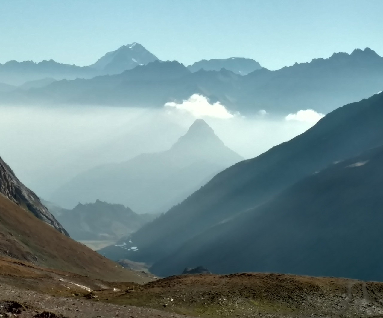
In the early kilometres we went out of Millau into the Parc Regional des Causses and near the Tarn river and gently undulated below high limestone cliffs. We passed a strange looking ruined castle that looked like it could fall off the mountainside at any moment and there were pretty Provençal type villages all over the place, some on the sides of the mountains. It was generally pretty scenery without being sensational, but I’ve become spoilt by the good stuff I’ve seen this summer. There were a few supporters in the villages, not like in the Tours marathon and less vocal but friendly nevertheless. I realise now that we were going generally uphill but I didn’t think about it at the time.

After the first few aid stations (fruit, slices of baguette with terrine or cream cheese or even Roquefort, madeleines, chocolate, raisins and then water, coke, orange juice and Orangina) I started to feel a little better. Typically for the first kilometre after each aid station I felt totally renewed and then I would start to fade again. I wasn’t bothered about my speed because I knew I had a long way to go but I would have liked to have felt I was expending less effort for the pace. There again the day had warmed up and I knew the heat would take a toll. I think I've become used to running in the heat over the summer so I wasn’t stressing about it.

We crossed the Tarn and everyone stopped to take a photo of a partly incomplete bridge with just one arch remaining. 

Then we climbed above the river and went through some quaint villages on the return to Millau. I had not appreciated how much we had climbed until now so I thought the descent would just be short but I heard someone tell a runner that after 30 km we had a gradual descent all the way back to town. The descent turned out to be so long that I even took walking breaks, something I never choose to do when going downhill, but I found myself unable to keep running the whole time. I also stopped to take a few photos just to have a break.


 Before 40 km I looked up and noticed a whole lot of paragliders above the closest mountain, and saw a couple of them landing in the field right by us.

By this time, with only a few kilometres to go to finish the marathon portion, I was really tired. I heard at least two people talk about finishing at the end of the marathon instead of continuing; I didn’t know at this stage how easy it would be to do that. I knew I personally wasn’t going to stop but I also believed I was going to feel completely destroyed by the end of my race.

We came back into Millau, ran through town which was very busy and into the start area, going right into the race building where the place to go if you wanted to abandon the race was all too clearly signed. We left Millau on the second loop going in a different direction and I tried to focus on what I had done rather than what still lay ahead of me. What still lay ahead seemed dauntingly difficult to me but almost immediately I felt a little better for having completed a marathon.

In hindsight with this being the hottest part of the day it wasn’t surprising I felt so bad. Although I would have expected to feel less exhausted after running a 5:12 marathon this turned out to be a reasonable pace in terms of wear on my legs.

The highlight of the second loop was our passing under the Millau viaduct which is an amazing engineering marvel. The road had been climbing steadily from Millau but the bridge was way above us. This part of the route was along a major road, closed to traffic but very exposed to the sun and the race organisers had put out extra drink stops which I really appreciated. For a while we had an aid station every two or three kilometres and without those I would have suffered greatly. 


There were two sizeable villages between Millau and St Affrique, our turnaround. Both had plenty of supporters and nice old buildings. At St Georges de Luzon I sat for a few minutes at the aid station (my only sit down all race) and felt a lot better when I departed. I was really loving the terrine sandwiches by this time, and the ham sandwiches, and avoiding sweet foods, but mainly drinking Orangina. 

Between here and St Rome de Cernon it was a gentle grade and we were off onto country roads. The sun was fading but the air was still very warm. From St Rome there was a massive hill. My only comfort was that once I reached the top and came down the other side I would be in St Affrique with 70 kilometres done. Everyone was walking the uphill. I made an effort to make myself like the feeling of the sun's last warm rays on my skin rather than dwell on how worn out I felt and other negative thoughts. Passing some patches of very enthusiastic supporters I did my best to smile; they were all reminding us that we would soon be on our return journey, saying "A tout a l'heure".

St Affrique was bigger than I expected. There was a lovely old stone bridge. The pavement cafes were bustling and we had to dodge traffic. At the indoor aid station I picked up my head lights and my long sleeved shirt and I left my race vest behind as I would no longer need phone or sunblock.

When I came outside again a transformation had taken place. The air was cool. I felt a new person, and I really could not believe the impact this had on my running. It was not yet dark but the sun had definitely gone. I managed to run up a large part of the massive hill out of town (about four kilometres) and all of the descent. I was on fire but I did not know how long it would last. For the first time I thought I could meet my pre race goal of finishing on the same day I had started: ie running under 14 hours and finishing before midnight.

This last 30 kilometres were quite lonely, especially after it got properly dark. Occasionally I would pass or be passed or a bike would whizz by. The bikes were well illuminated but some runners didn’t even bother with lights. It was very peaceful and I enjoyed the solitude. Mostly I enjoyed the temperature. The aid stations and their cheering crowds had quietened down a lot and the two villages were closed up for the night. The moon had not yet risen and there were a few stars, and a runner pointed out Mars to me; I had last seen Mars from Rifugio Carestiato on the Alta Via 1. He complimented me on my even pace and then ran off into the night. It was true that most people I saw were walking.

The five kilometre markers were painted on the road so I knew how I was going. I was very excited to get to the start of the climb up to the underneath of the viaduct because I knew this was the last hill and I would soon be descending into Millau. Of course I had forgotten some bits of the route within Millau so this last section was longer than I anticipated, but at least it wasn't unpleasant. 

By now the moon was just over the horizon, a large orangey ball, almost full. There were some people sitting in the darkness at one intersection and they called out “Allez Monsieur”. When I said “Madame” they laughed and apologised profusely. At 97 km there was an aid station and I saw the 13 1/2 hour pacer stop there - he was just ahead of me and was the only pacer I had noticed all evening - so I decided to skip the aid station and try to run under 13 1/2 hours. I was rather surprised that in the closing kilometres I felt more comfortable than I had felt at the end of my marathon six days ago but there I was maybe trying harder.

I ran up the street to the race HQ and turned into the park, then slowly slowly reached the finishing arch and finally went indoors to cross the finish line in 13 hours 18 minutes. (This was my clock time and we never did get an accurate chip time.) It was a great feeling but I could barely raise my head let alone my arms. Strangely, I felt sleepy and collapsed onto a chair. I didn’t get much done in the next few hours.


Monday, 24 September 2018

Marathon Touraine Loire Valley, September 23


It was wet and windy for my marathon today, quite a change from the hot weather I’ve had almost all summer in Europe. The Marathon Touraine Loire Valley (yes, English spelling) sounded like a pretty race going through little villages and along the Loire river, starting in the centre of Tours. I found it quite humid at first and I worried about that, and also the road seemed slippery in the wet.

The route took us along small roads and bike tracks (Loire à vélo) through farmland (that means cornfields and other vegetables) - I recall a huge field of bright green spinach leaves - and some light forest. We ran alongside a small river for a while. The highlight at 19 km was running through the grounds of Chateau Villandry, a pretty castle in pretty grounds, although the path was very slippery. Next door to the castle was a nice looking Romanesque church. A lot of the route wasn’t all that exciting, a bit like running the Traralgon Marathon with a castle thrown in and the supporters calling out in French. On the return part we came through several villages, all tiny.

As usual in France the supporters were great, calling out enthusiastically ‘bravo’ and ‘allez Julia’ and never once saying I was almost done. In the villages people leaned out of their windows and stood by their front doors to encourage us.

The aid stations were frequent, mostly with just water, and fruit, raisins and ginger cake (not so nice). They gave us a whole bottle of water each time, which was far too much on such a cool day but would have been wonderful in hot weather.

I tried to keep up a decent pace but the headwind was quite strong at several points. The route was basically flat. We did a sort of rectangular shaped course and on the way back there was a lot of tailwind. Despite that I slowed in the second half, but in the later stages I was passing loads of people. I managed a spurt to the finish line.

Once I finished and met up with Denis I realised I was really wet and getting cold. I didn’t see the paella party mentioned on the race website and we went straight back to the hotel, then we went out for great pizza.

Wednesday, 12 September 2018

Tour of Mont Blanc


This alpine hike was the focus of my whole trip and it did not disappoint. Eight days of unparalleled hiking enjoyment over about 175 kilometres in three countries around the perimeter of the Mont Blanc massif. I had, for the most part, perfect weather and the feast of glorious views will be hard to put into words. Almost every day I was able to indulge my love of hiking uphill with climbs of 800 to 1300 vertical metres. The descents always felt longer to me, though. My fears about travelling too light and having made my days ambitiously long came to nothing and I feel that there is little I could have changed for the better. The only items in my pack that I never got to use were my rain pants and my earplugs, and that has to be an indication of a good time.

Sunday 2 September
A longish climb out of Courmayeur (1226m) in forest with a few openings to look back down on the town. And then I was above the tree line with mountains all along the horizon. I knew then and there that this hike would be ok! As I approached Refugio Bertoni there was a helicopter landing with supplies, which seemed to be cartons of wine bottles. There were helicopters buzzing around all day keeping an eye on things at the UTMB which was finishing this afternoon.

The trail contoured for a long while, passing some derelict huts, and I reached Refugio Bonatti where I had my first clear view of Mont Blanc. The hut terrace was very busy, but that’s no surprise in such a setting. I then had to descend all the way back down, cross a river and climb back up again. The climb up was busy with day trippers and it looked to me that the clouds might be moving in. There was a refuge half way up, where the daytrippers were stopping, and then the climbing got serious. 


After a while I was in cloud which lasted right up to the Col Grand Ferret (2537m) and there was nobody much around. At the col I peeked over the other side and where I should have seen Switzerland there was ....nothing. I put on beanie, gloves and jacket and sat down to eat lunch. The descent was at a pleasant grade and the cloud cleared a little to reveal grassy mountainsides.

I arrived at my destination refuge, La Peule, which is still a working farm. So there were noisy cows and lots of pigs. The sleeping arrangements were one big dormitory and outside toilets. It was very cold inside and out. We had bread fondue for dinner and the atmosphere was more social than my previous experiences. (This proved to be a feature of the whole hike.) Everyone was in bed before 8pm and the snoring was bad.

Monday
It was still cold in the morning and you couldn’t see much, but the cloud was moving around so Switzerland was going to be on display soon. In the morning I went through several quaint villages, with stretches in forest and across meadows and I got some mountain views. The cows had the biggest cowbells imaginable. The buildings were mostly stone so the villages looked quite different from the timber Austrian villages. There were lots of hikers around. I stopped for coffee at Issert.


After Issert the trail climbed in forest, high above Orsieres, and the trail was well marked by striped poles remaining from the UTMB. I got finally to Champex and its lake, but it was very windy by the water so I just ate my lunch there quickly and went on to see where I would be continuing tomorrow.

I stayed in a hotel down in Orsieres, off the trail, and I had a long wait for the bus. While waiting I bought Rivella for old times' sake and chocolate.

Tuesday
I had a late start because of the bus times, but this turned out to be one of the best days. The weather had improved dramatically and was pretty much perfect for my assault on the Fenetre d'Arpette (2665m). I was also very happy to find my sunnies safely in my pack because I had been convinced yesterday that I had lost them.

I started with a gentle amble out of Champex, crossing meadows and climbing gradually. Quite soon I could see in the far distance what was obviously the fenetre: it was a slight and almost rectangular dip in the mountain range that spread across the horizon. The climb got steeper and moved onto scree. Then there was a huge boulder field to cross with some scrambling, but the route was well marked. The last section was a steep zigzag. The view at the top was unexpectedly amazing: the Trient glacier being the main feature, but it was only one thing among a selection of glaciers and peaks. The fenetre (the hotel owner had told me sternly this was a fenetre and not a col) was crowded and noisy. I sat there for half an hour.


The descent was quite hard, steep and often slippery. It took several hours but the views of the Trient glacier and then further glaciers compensated and I quickly left the crowds behind. Even when I got back into the forest I still had a long way to go. After ages I came to a derelict hut with a terrace overlooking the mountains, and then much further on a live hut. From here I followed a stream towards Trient, still quite high above the river fed by the glacier, and came down to the village. Trient's highlight is its pink church. There is a choice of two hostels in the village and nothing else. We had potato fondue for dinner.


Wednesday
Another really great day. The climb out of Trient was fairly steep but I made good time and passed a lot of people; only a trio of French guys passed me. The Col de la Balme was a surprise for suddenly there were amazing views of the Mont Blanc massif. 


Most people appeared to stop at the col but I continued on into France and the views got even better as Mont Blanc itself came into view for the first time in a couple of days. All the way up and over the Aiguillette des Posettes (2201m) I had this great view and this area was mostly devoid of other hikers. The descent to Tre le Champ was an anticlimax. 

I stopped for a coffee at Tre le Champ and saw the French guys eating lunch. I headed off soon but then wasn’t sure if I had the right path; I saw the French guys approaching and they assured me I was going the right way. I followed them closely but then I suddenly rolled my ankle and stopped for a few minutes. The ankle settled down but I had lost my guides. After a while the route didn’t accord with my guide book and I started going the opposite way to the signs; this proved to be the right thing to do and after three such actions I was back on track.

The ensuing climb to the Tete aux Vents (2132m) was full of hairpins and steep, featuring higher up a sequence of metal ladders and other aids. The area was really busy. At my first ladder there was a lengthy hold up because a large group of very slow people were coming down, but after that it was plain sailing and not at all scary. The Tete aux Vents was windswept and nobody lingered despite the views, but I ate my lunch there. 


I then had a gradual descent to La Flegere refuge which was at the top of a cable car, spotting a snake on the way. There was a massive queue at the cable car station so this part of the trail was obviously popular with daytrippers. The hut was pretty basic but good company, and another very early night with lots of snoring.

Thursday
The weather was clearly deteriorating, with dark clouds from early on but a nice panorama of mountains. I marched along uphill not too far from the people I had eaten with at the refuge. I went a bit wrong, then I saw them go wrong. Then I went badly off course and ended up on a boulder slope which was tricky. I looked back and saw exactly where hikers were turning off the trail I had been on but instead of turning back I hoped I could meet the right route ahead. Of course I couldn’t and almost ended up back at La Flegere, so I had to retrace my path through the boulders and took the missed turning. At that point I realised that I had read about this turning in my guide book and even highlighted it.

The remaining climb to the Col du Brevent (2368m) was stony and away from the high mountain views and during this time there were a few spots of rain. And some pale rainbows. I was checking with everyone coming towards me that I was going the right way, and I asked one group in German because I thought that was what I had heard them speaking; it turned out they were Danish but fortunately I was too focussed on climbing to mention how I had been told that Danish was more of a throat disease than a language. It was amusing asking people where they were going or coming from because of the different ways people pronounced the refuge names. 

The final climb to the top of the Brevent cable car (2526m) was rocky and steep and at the top is supposed to be one of the finest views in the Alps. Not for me. Just cloud. But at least I got the view for part of the approach.


The descent was at first a pleasant amble secluded among rocky hillsides, passing a pretty lake and a hut perched on a cliff. It was a long way down to Les Houches (1007m), my longest descent of the whole hike. As I came into the forest the rain started in earnest. 

I emerged briefly from the forest at a parking area with picnic tables that seemed to be staying dry under some trees and sat there for a while, then went on down. I had put on my pack cover but I wasn’t getting all that wet so I didn’t even put on my jacket. From here the route was harder to follow. I was a bit on the road, back in the forest and back on the road. I ran for a while. Finally I saw the Les Houches railway station and from here it was not far into the deserted town. I stopped for coffee at the first cafe I saw. What’s this obsession with coffee? Answer: the breakfast coffee was never any good. Only Austrians do decent coffee at breakfast.

I stayed at a hotel in Les Houches that was back past the railway station, with a nice view of the mountains except that they were mostly in a swirling mist. (A week later I came through Chamonix on the bus and saw Mont Blanc perfectly from this side. I also marvelled at how high up were the La Flegere and Brevent cablecars.)

Friday
This was the least exciting day of the hike, mainly because of the weather. Les Houches was all in cloud when I woke up and it only lifted a little by the time I was on my way. I had breakfast at the bakery, very nice, then I had a stiff climb on a ski access road up to the Col de Voza. It wasn’t especially high and had a big hotel. Here I had to make a decision about taking the low route or the high route to Les Contamines. The col was completely in cloud so I had no choice but to take the low route. 

The route was a mix of forest trails, farm roads and sealed roads and went through several atmospheric villages. It was all very old, including some tiny chapels. The clouds shifted a little but never properly lifted. I made lots of short stops. Les Contamines was a long village with a few hikers hanging around and I stopped for coffee at the first place I saw. I wanted lunch but it seemed I stopped at the one cafe that didn’t do food (as the owner grumpily responded to my request for a sandwich).

I stayed at a hotel on the edge of the town, but if I were planning now I would go on to the next refuge. It’s a problem with this hike being so popular that you have to commit to your accommodation a long time in advance. I met so many people whose daily distance was dictated by hut availability.

Saturday
I was so delighted to wake up to a perfect blue sky. I marched rapidly out of Les Contamines, passing the church of Notre Dame and climbing on a rough road, built by the Romans I understand, at a gentle grade up to a couple of refuges. From there I ascended through meadows to the Col du Bonhomme where there was a tiny hut and huge views of alpine grasslands and rock faces. There was a group of French hikers paused there who were doing this hike for the seventh time. 

The trail became rocky and scree from here, climbing gradually to the Col de la Croix du Bonhomme. Magic views in all directions and it was going to get better. I continued climbing and reached the Col des Fours (2665m), like a cutting through red rocks. Two sets of French women had brought their dogs up here and they had quite an altercation about the dogs' behaviour. From here you could see Mont Blanc again for the first time in ages but it was partly hidden by the Tete Nord, so I climbed that. One of the dog owners came up also and told someone else in great detail about the poor attitude of the other dog owner.

At the Tete Nord (2756m) was a plaque labelling everything in sight and more. Even Aime was marked! I was pretty close and I could no doubt see the glacier I ran on. Mont Blanc was very clear, actually15 kilometres away, but you couldn’t see the intervening glaciers and lower peaks. I had lunch up there.


The descent from the col was long and steep at first, crossing lots of streams and passing plenty of cows. Everyone seems mesmerised by the cows and stops to take pictures. Some have big horns but they’re all tame, in my experience. I was alone most of the time, heading for the valley far below. I came to a farm road and some deserted buildings, then crossed the river and walked up the valley to my destination refuge. 

Les Mottets was definitely the nicest refuge I used on this hike. It was a former farm with the cowsheds being the dormitories (they had about 40 beds each in a long line) and it was set right up against the mountains. I was given two mattresses in a little alcove along the line so I felt like I had my own room. Across the hillside were hundreds of cows jangling away. There was a great friendly crowd at meals. For dinner we had soup, cabbage salad, meat stew with vegetables and rice, creme brûlée.


Sunday 9 September 
Perfect weather once again. This was the only time to my knowledge that someone saw me preparing my illicit lunch, while he did the same. I set out on the climb above the refuge to the Col de la Seigne (2516m). It wasn’t a difficult climb and the view up there was one of the best. Mont Blanc was very close and there was a romantic vista of clouds hanging in the valley directly ahead. I lingered for a while and even accepted an offer to have my photo taken.


I continued on in the direction I had seen others go, now back in Italy. The path seemed very multi-stranded and I didn’t worry too much which strand I took. After a while I came to extensive scree slopes and on one of these was a patch of ice. I decided it was time to try out my crampons (even though there was a path close by that avoided the ice) and, much to the amusement of a Frenchman who watched me, I walked comfortably across the five metres of ice. The Frenchman continued ahead of me as I sat to remove the crampons and I watched him traverse the scree, climbing steadily. It occurred to me that I might not be going the right way since I wasn’t meant to be climbing and I could see no one who had left the col ahead of me. When I reached the top I learnt for sure I was in the wrong place. The man was still there and I told him where I expected to be; he laughed and pointed out Refugio Elisabetta I was aiming for far away in the valley. However this Col de Chavanne (the French name was a clue that I had erroneously returned to France) was a junction with the local Alta Via 2 (not to be confused with the Alta Via 2 in the Dolomites) which also passes that refugio. So I was able to descend easily and rejoin the correct trail. It was my own 'variante' as the Frenchman said, and I'm sure an improvement on the main route.

From the refugio I headed down the valley and then had another climb through meadows to an outcrop which marked my last high point of the hike. The view across to the Mont Blanc massif, glaciers and all, was wonderful, with just a few clouds hovering. I had this view to my left for hours. There were some marmots, screaming just as they did in Austria. (The first time I heard a marmot scream, on the Adlerweg, I got a huge shock because I was just having a toilet break and I thought someone must have been watching me and blowing a whistle!)


The trail headed down a bit passing lovely round lakes, through light fir forest and then entered the Courmayeur ski area. This wasn’t quite so beautiful. The final out of town stretch was down a very sandy forest trail, quite steep. I could already see Courmayeur clearly. From the forest I emerged in Dolonne which must be the original settlement, judging by its old stone buildings and narrow streets. 

And then I was back in Courmayeur. With filthy legs and shoes from the sandy trail. I went straight to a cafe for a cappuccino and a brioche and looked up at the mountains. The mountain views were so much clearer than when I had left the town eight days ago and the town seemed very lively for a Sunday. I never got the impression that many people start and finish the hike in Courmayeur but it seemed perfect to me. Not only is it the town you would most want to spend time in, for me doing it like this resulted in the less interesting days being tucked away in the middle of the hike.

Saturday, 1 September 2018

Running (for a change)

Roman arch, Aosta

Ok, so I’ve been doing a lot of hiking recently but I have also done a bit of running. Not much, but just enough so I don’t feel I’m forgetting how to do it. Or how nice it feels. 

This morning I went for a run along the river in Aosta (Italy). Flat, lots of oxygen available, no chance to get lost. So it wasn’t the most exciting run but I got to shake my legs out a little and the distance was marked out on the path so I knew how much I was doing. The river was fast flowing with lots of ripples of white water and bushy along the banks. I was running on a bike path and on the opposite bank was the highway. Beyond my path we’re playing fields, a rather dismal looking caravan park and some industrial stuff. But beyond those not so special things were the mountains. It was a bit cloudy so the tops were hidden, but I could see lots of small villages, churches and even small castles. I think Mont Blanc is close but I couldn’t see it. All up I did just over ten kilometres.

In Innsbruck (Austria) I also went for a nice run along the river. I ran from the centre of town to the airport, around the edge of the airport and on to the end of the track. This mad for a fifteen kilometre round trip. I had done the exact same run in the winter at the beginning of 2016. Because of the snow on the ground and the general feeling that it wasn’t really running weather, the run seemed like a lot longer that time.

It’s a lovely run because it’s far from the roads, there are little parks and I got well beyond the built up area. The first time I went I didn’t know how far I was going to go so I would just decide to run as far as the next bridge, a certain church I could see, then the airport tower, then the main road in the next village. Coming back Innsbruck had woken up and the streets were busy. Every time I come to Innsbruck I try to work out where the marathon (Tirol Speed Marathon, now discontinued) that I ran here in 2006 finished, where we (the fam) all sat in the street and ate chicken and drank beer and Natasha had to help me get down the stairs to the toilets so I could change, but I never can get the place. 

I did a very short run in Garmisch Partenkirchen (Germany) up to a small lake and a historic Olympic bobsleigh run. The lake was tiny, the hotel beside it may have been bigger than the lake, and I was surprised how quickly the town became rural.

Moving backwards, I had a wet run in Fuessen (Germany) after Sophie and I finished the Lechweg. I was just intending to run around the town, but I went up the hill to the main part of the castle/palace and found some forest trails beyond there. I went along a trail that was heading to some viewpoint but I didn’t go the whole way as there would have been no view since everything was in cloud. I came down on another trail and ended up by the Lechfall where the Lechweg ends. It was some kind of tourist enclave with several hotels and restaurants. But better than that I found a couple of lakes and a ski jump.

In Albertville (France) I went for a couple of very enjoyable runs. The first time I went up the hill past the old Medieval area of Conflans and continued up until I could join another road and come down a different way. It was quite an uphill slog and a hot day, but lots of huts and meadows to look at and I think it was on this year's Tour de France route. As I plugged on with the uphill I wondered if there really was a junction where I could turn back, and I was most surprised to see a woman walking her dog emerge from the junction when I got there. The other time I did a shorter run through a couple of neighbouring villages. I had taken a sketch map with me but about half way the reality did not exactly match up; I saw a woman on her balcony and asked the way, then her husband appeared and told me where to go (what was a road on the map was only a makeshift trail over grass). It worked but I ended up with a short cut to my planned run.

I had several lovely but hot runs in Cologne (Germany) along the Rhine and found some trails passing small beaches and meadows, and even a bit of forest. Then I ran through parks in the green belt to the west of the city, aiming for the Aachener Weiher which is a square reservoir. On this last run I got quite lost  and it took me several attempts with my halting German to get someone to explain where I had to go.

Ditto with the heat in Geneva (Switzerland) where I ran twice. The first time I ran along Lac Leman as far as the Botanical Gardens, where it seemed like everyone else runs when in town. Nice lake to look at and gardens. But it was so hot that I felt faint when I got back to my hotel after nine kilometres. The second time I went to the same place but intended to go further. It was the Swiss national day (August 1) and lots of revellers were still out from the night before. I thought the Swiss were very neat and tidy and law abiding but there was litter and bottles everywhere. And the Botanical Gardens were still closed when I was there so I couldn’t get inside.


And going right back to the start of this trip I went for a run in Canterbury. I left my room at the Weatherspoons just as the pub was opening at 7am. Otherwise I would have been locked in it seemed. I ran out of the town and after an initial missed turn I followed the Pilgrims Way for a short while. I went through a village and then along rural lanes and it all felt very English.

Friday, 31 August 2018

Alta Via 1 (part of) hike, Italy


Another wonderful hike, with unexpectedly spectacular scenery. I’d seen pictures but nothing prepares you for the real thing. It was such a contrast here on Alta Via 1, in the Dolomiti Bellunesi of northeastern Italy, to last week in Austria, in part because of the paleness of the limestone rock, the unusual shapes of the mountain peaks and the closed in feel as I hiked high above the tiny valleys. There weren’t the expanses of tussocky hillsides and the jangling cows/sheep, and there weren’t the frequent gushing creeks. The atmosphere was of great quietness and the weather was perfect. In this I was rather fortunate because during my two days break in Lienz and travelling to Belluno it had snowed heavily in the Dolomites and some of the Alta Via 1 was impassable.


Monday August 27
I took the bus from Belluno to the walk start at an isolated bus stop called La Pissa. Actually this is the walk finish, as I was hiking in the opposite direction to the way the route is described, but this suited me as it meant I didn’t have to decide how far I would hike just yet; my route guide had all the bale-out points. It was hard to find the trail, the only disadvantage I found (over my three days) to hiking in my direction.

I had a long climb in beech forest with occasional views, and with these views I soon realised the extraordinary nature of these Dolomite mountains. They are such odd shapes, so abruptly steep sided, and so dry. No cows, very few huts, no streams and few meadows. After a while I reached a rifugio in a clearing and then I climbed to a pass (just marked by a tiny shrine to St Francis), now out of the forest. I reached the Rifugio Pian de Fontana where I had thought I might stay, but decided to continue on to the next rifugio (where I had a booking anyway) as it was such a beautiful day, not a cloud in the blue sky and only early afternoon.


The afternoon's hike was one of the best I have ever done. I had a steady climb up the valley on grass and scree with scree slopes all around. The rock is pale here so the whole feel was of lightness and airiness. It was a long and arduous climb with several 'lips' that I mistook for the pass into the next valley. I was passing small patches of snow.


When I reached the pass I was confronted with an unbelievable view of mountain peaks of all sorts of shapes and plenty of snow, both on the peaks and on my trail. There were snow stripes across the more bare mountainsides and it was altogether almost a lunar landscape. 


I hiked carefully along the trail with several snowy interludes which slowed me a little. I crossed many scree gullies, all dry, and could see Rifugio Pramperet on a grassy hillside from far away. The final descent in low pine forest was easy and quick.

The hut was busy and the food was good, with tagliatelle alla Gorgonzola for entree. It must have been German night because the main was frankfurters and dessert was strudel, but I took the vegetarian main option of pieces of tangy cheese, mushrooms and a slab of polenta. Later the owner, also called Giulia, offered me a Grappa and had a chat with me so I could practise my Italian.

Tuesday
Another day of perfect weather. I felt tired right from the start and took it easy. I started with a long descent, which meant I would have a climb later. I meandered in and out of forest, passed lots of hikers and went over a pass. On the far side were long stretches of trail over scree and craggy mountains close to hand. Then I came down through forest and had a couple of kilometres on the road, ending near two rifugios with full car parks and jangling cows outside.

The last forty minutes was on a gravel path climbing sharply. I couldn’t imagine why the path was so busy until I realised people were going up to the rifugio for lunch.

At the top I came upon Rifugio Carestiato quite suddenly. It occupied the entire hilltop, which is to say that the actual hilltop was only big enough for the rifugio - you couldn’t even stand at the same height as the building to take a level photo. The setting was incredible: the place was surrounded in every, and I mean every, direction by high mountain peaks, mostly bare rock and vertical sided. I hadn’t booked but they found me a bed in the annex. 


I had lunch of gnocchi al ragu on the terrace of the rifugio and spent the afternoon strolling around and reading in various scenic spots. At dinner I shared a table with a French woman who was an ultra runner: a win-win as I got to speak French and enjoy the topics. After dinner I sat outside and in the half darkness the mountain outlines made an amazing silhouette against the blue-black sky.


Wednesday
Another chance to admire the amazing 360 degree view from the hilltop hut:

Then I set out, a bit among the scraggy dwarf pines and then out onto the scree to traverse those enormous mountains, their peaks towering above. The mountains were so close to my right and the steep drop down to the valley was so close to my left. In some places the scree path was slippery and I fell once, and ran down one short slope fully out of control.

After hiking through one bowl where I seemed to be completely enclosed I reached a pass and then entered another bowl. Just magnificent, and I was grateful to the hikers at Pramperet who had suggested I stay the night at Rifugio Carestiato and then hike on the next day. Those steep sided bowls with impossibly high sides of limestone and scattered forest were something else.


I had stretches in forest but most of my morning was out in the open on the scree. The last few slopes had creeks trickling down, almost the first running water I’d seen here. Then I joined a dirt road, just before Rifugio Vazzoler, for my descent to the village of Listolade. The dirt turned to tarmac after a kilometre or so. I had not had high hopes of this road but it was a surprise: it was alongside a creek the whole way, passing waterfalls. All the way down I could still see high mountains all around.
I arrived in Listolade and checked the bus times. I just had time for a cappuccino and to use the toilet before catching the bus back to Belluno.

New blog from July 2020

  New blog I have started a new blog. Not quite sure why. So check it out juliathorn2.blogspot.com